The Benson Lake Loop

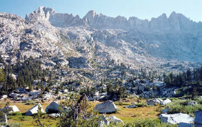
Once I broke above tree-line, I was blessed with this view of Sawtooth Ridge over a rocky meadow. The trail goes just below the low ridge on the right, and at the end of the ridge, the trail begins to climb
Sawtooth Treeline
The Benson Lake Loop, August 2002
Saturday, August 31th, 2002. 8.2 miles, 1019 Foot Gain, 2210 Foot LossI woke up to mild conditions, even though it was damp in my bivy-tent. The previous morning the inside of my shelter was dry as a bone, but not the ground sheet. No matter, I was up and packing what I could and putting things out to dry.
I walked around a bit to take pictures and look at the morning light on the surrounding peaks and ridges. I finally sat down to breakfast and before long, I had just about everything packed except for the still damp shelter, now drying in the strong morning light. It was a typical Sierra day: clear, sunny and cool.
Finger Peaks above my perfect little camp.
Finally the bivy-tent was dry and I was able to pack up and leave after a last long look at the ideal level grassy area next to the infant Piute Creek. I would be crossing that creek again in two days, but the creek there would be dry. The valley (the upper section of Slide Canyon) I was in was, like many glacier basins, in steps. The step that my camp was on was a small one compared to other canyons I have visited, and standing at my camp step I could look down canyon at several obvious level small steps that met the large open white granite area mid-canyon. Among this meandered Piute Creek in a garden-like confection of boulders, grassy areas and small intimate clumps of trees that must resemble a well kept garden during the flowering part of the season. I still saw flowers all along the hike, but main flowering season was well past.
The trail edges around the meadow where I could look down canyon towards Crown Point in the distance.
Turning up canyon, the trail weaved through a garden of grass and trees and a few flowers along the creek then veered away to climb and then emerge into a large open meadow area rimmed with groves of trees. The trail skirted the meadow, turning it on the right. The area allowed unobstructed views of the canyon walls and the jagged white teeth of Sawtooth Ridge above. Once the meadow was passed on level trail, it began to climb towards Burro Pass among short steps made for giant feet. The trail had manmade steps of its own here in there, but for the most part, the climbing was at worst moderate and actually enjoyable. Rest-stops were a treat in the open terrain, with great unobstructed views down the canyon.