The Benson Lake Loop

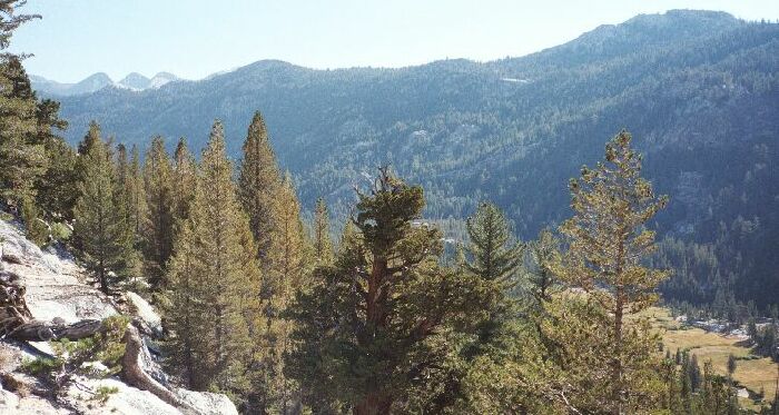
Matterhorn Canyon from the trail going up to Wilson Creek Canyon. The trail junction is not far down there, and the PCT climbs the ridge ahead. A nice selection of conifers can be seen here.
Leaving Matterhorn Canyon
The Benson Lake Loop, August 2002
Day 4: 6.4 miles, 2060 Feet Gain, 1249 Foot LossAs usual, it was a cool and sunny morning. It would be a long time before the sun hit my camp in that canyon, so some thing got put away a bit damp because I was anxious to get going. Back on the trail I soon hit the junction and I was on the Pacific Crest Trail (PCT), sometimes known as the Pacific Crest Freeway. It was wide, worn, maintained looking and there was obvious evidence of horses that served the large number of trail crew that lavished too much attention on the PCT at the expense of other tails.
Immediately after the junction I passed into a good-sized meadow and the stream crossing of Matterhorn Creek. The easy stream crossing made me glad it was late season, because I knew from the looks of the stream-bed that early season would be a fairly safe but thrilling crossing through swift water. I have to question the through-hikers that come through the Sierra very early season, sometimes at the very height of the mosquito season (July), and the very height of the spring run-off. As I write this we are in the midst of a very wet season that premises to swell all streams and rivers into mid season. Next year early season the Matterhorn Creek crossing will be very interesting, and the Kerrick Canyon crossing beyond may be near impossible. While passing through the Sierra is always wonderful and there are unique things to see early season in late winter conditions, PCT through-hikers are really missing out by not seeing the Sierra at its best at the height of the flowering season. If the PCT actually followed the Sierra Crest, treacherous stream crossings well down into Sierra canyons would not be as much of an issue.
Looking down trailless Matterhorn Canyon from the trail going up to Wilson Creek Canyon.
After the stream I passed more camps and entered the thick forest trail that sometimes passed within viewing distance of the many meadows of the canyon bottom. Along the way I passed a huge beat-out packer trail-crew camp on my left just before the trial began a decided uphill trend. Before long I reached the switchbacks below the hanging canyon valley of Wilson Creek. I found this climb to be fairly well graded and pleasant with very fine views up and down canyon, once the trail climbed above the canyon bottom trees. The canyon architecture was still very "yosemite" in attitude, if forested in its vertical nature.
I took a break now and then to talk to the now more numerous hikers (all heading in the opposite direction) and to take in the ever more engaging views up and down canyon, but I still managed to reach the lip of the canyon in short order.