Circle the Cirque Crest

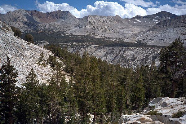
Striped Mountain, Mt. Pinchot and Mt. Ickes in the Pinchot Pass area is the backdrop for the descent into the Muro Blanco. Note the beginnings of the bench which Bench Lake sits on.
Down and Up Again
Circle The Cirque Crest - By D.W.Donehoo (All rights reserved)
Day 8. Saturday, September 6. Another fine morning, with just about as early sunlight as you can get. As soon as the sun cleared the Sierra crest, it was on us due to our lofty perch on the lip of the hanging valley. Sadly, we would lose altitude we would not gain back for the rest of the trip, so we were unhappy to be leaving the "real" high country.
This is the beginning of the hike downward. So far only the most faint of trail can be seen, but down there in the bushes it appears for good and becomes a very good trail. The Bench Lake bench can be clearly seen.
Soon, we were packed and crossing the lake outlet to find the trail. Someone had told one of us the trail faded out a little ways below. Wrong! We had no trouble staying on the initially faint trail, but soon it began to look down-right groomed as it switchbacked downward, following my map trail notes exactly.
Half way and at the trail traverse, the Blanco awaits with its bush and talus. Doesn't look so bad from here, and actually at this end of the Blanco it is not so bad. See those fans of talus down there?
About half way down it traversed over to another wooded section right on schedule, with only an easily bypassed blowdown to deal with. It was in this segment there was a trail section so well built, clean, and protected that I could not believe a trail crew had not made a recent visit. Further below was a confusing section of mini-trails that showed the age and lack of maintenance. I kept expecting the trail to just fade away any minute but it was solid all the way down. Finally the trail reached the bottom in deep forest near a meadow, and finally the trail really did disappear.
Looking back I could see it would not take much for the National Park to repair this trail. I know there are those who would like it to stay the way it is, but the fact remains the trail is there and will stay there for some time to come, and for as long as people and deer will use
it. As it is, due its present condition, its lack of repair only encourages even more damaging trails of use and trampling of feet on fragile high alpine areas that should be on existing trails. Ideally, if it were done my way, I would have the trail repaired from the point where it now fades in the Muro Blanco, to Marion Lake. At the bottom there would be a big sign saying "NO PACK STOCK BEYOND THIS POINT!". The area would be a foot travel reserve. From the sign to the east side of the last talus area going east, I would allow to remain as wild and trailless as it is today. The talus alone should help deter pack and horse travel. From the last talus area to the John Muir Trail, I would maintain the existing trail, but at the junction would be another sign saying pack animals in the Cartridge Pass and Lakes Basin area is strictly forbidden. The whole area would probably be a bit more visited, but then be less impacted by use trails and other aimless wondering, when even today there is a trail mostly already there to use, but not sufficiently visible to guarantee people are even aware of it enough to use it. Your opinion may vary.