Deadman Canyon Loop
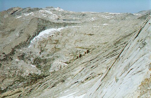
There almost exactly mid-horizon is Elizabeth Pass at the low point. See the trail? No? That is because there is none. This view is from the south side of the pass.
"The Trail"
Deadman Canyon Loop - By D.W.Donehoo (All rights reserved)
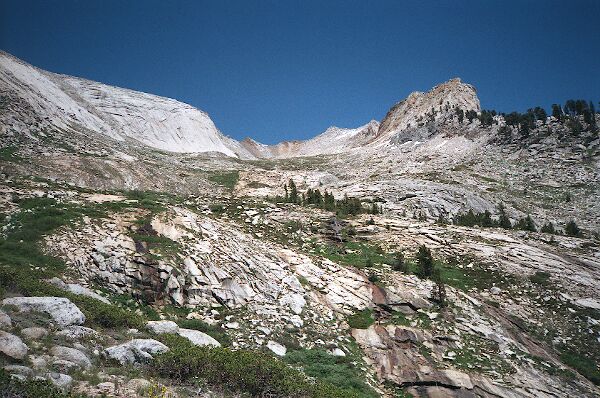
At the summit of the pass, you will find a park boundary sign, a register wrapped in plastic, plenty of flat dry ground on which to at last drop your pack and really staggering views on both sides of the pass. This is the payoff for all your hard work coming up the pass. To the west you can see large Moose Lake (it's unlikely there were ever any Moose at that high and exposed lake) and Alta Peak. To the south is the Kaweah River Valley, and the "shoulders" of the Angel Wings of Valhalla. Below is the valley of Lone Pine and Lone Pine Creek. Those with energy and time to spare can summit the high points on either side of the pass, or perhaps travel northwest on the north side of the pass until you can look down on Lone Lake and all the great views that airy perch offers. If you brought a camera, take plenty of pictures, because this is literally (and possibly figuratively) the high point of the trip. And sign the register, because the opportunities to engage in this practice are few.
From the pass you can look across the Tablelands to Moose Lake.
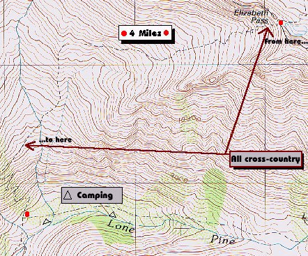
The map says there is a trail, but there is none between these two pioints. At least when I was there last.
Sadly, sooner or later, you have to leave and depending on how far you have to go next determines how long you get to stay at the summit of this pass. In any case, you still have a long ways to go to get to camp. Once again you shoulder your load and hit the trail down the west side of the pass until....the trail disappears. On every map you care to look at you see a trail on either side of the pass: in fact there is no trail at all. What you see on the west side is cairns at about 200 yard intervals leading down to Lone Pine. The way could not be more obvious: you simply go down hill and the cairns are good for locating the real trail when it resumes its tread near the Lonely Lake outlet stream at about 9600 feet. Some maps say it is 4 miles from the pass to Lone Pine, others say 3.1, however, it seemed to me to be more like 6 or more miles of steady hiking.