A Backpack Cross-Country Traverse of the Minarets
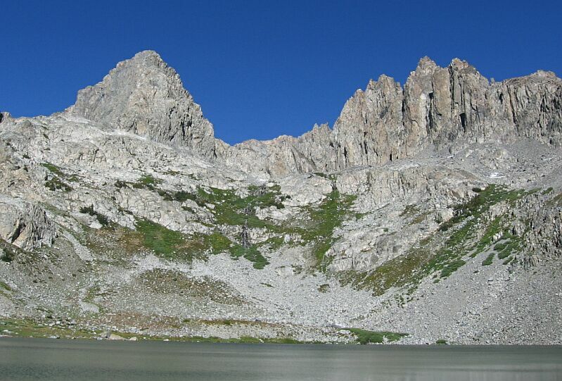
A small waterfall over Deadhorse Lake is dwarfed by the towers of the Minarets. On the other side of that wall: the north fork of Iron Creek and the head of its canyon. All around, peaks with no map names. I assume the pyramid on the left is what Secor calls Starr Minaret (~11341 feet) and is listed as Class 2 on the other side. Starr and Ansel Adams first climbed that peak.
Deadhorse Lake
A Cross-Country Traverse of the Minarets, August/September 2006So many pictures, so many choices. Well, we are really in the Minarets now, surrounded by numerous spires, almost too many to count. Above us was a skyline so jagged you could almost saw logs with it. We were in a bowl surrounded by towers of rock, and not a dead horse in sight.
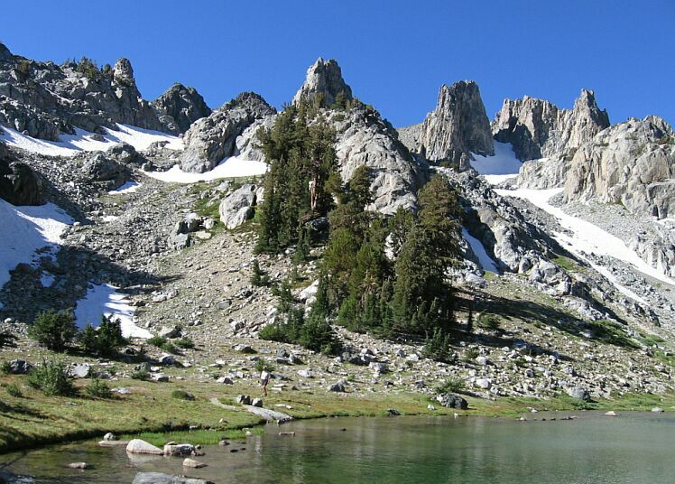
The Minarets seem to specialize in mirror surfaced lakes surrounded by groomed looking lawns, picturesque groves and towering rock spires. This particular lake looked like you could easily walk around to the west shore to the far end via the south shore without running into any talus. The north shore was a different matter. There was some faint fisherman trails here and there, but but not a lot sign of visitation by man or animal. What sign I did see was no more than game trail.Dave tours the south shore of Deadhorse Lake. Those are glaciers up there, or what is left of them. See them now while your can.
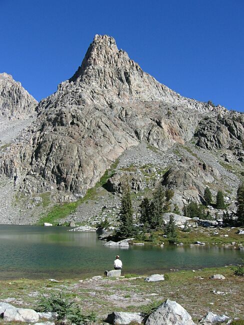
The chore of getting to Dead Horse Lake and the attractions of nearby Minaret Lake probably keeps visitation low, and my experience says that most who do bother to get to these remote places have good outdoor low impact manners. I think these lakes, being so relatively close to the trailhead is evidence of this. That and the fact that the numbers of backpackers is tapering off. I think pictures like the above show people why fragile places like this needs our protection.A ~10856 foot spire that sits to the west of the big fang over Minaret Lake. The west lake shore is shown here looking north.


