The Ottoway Lakes Loop

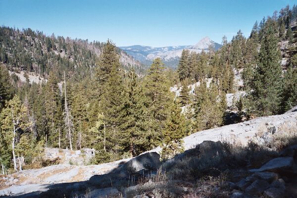
Leaving the thick forests behind at last, a nice view back to Mt. Starr King.
Getting Alpine
The Ottoway Lakes Loop, September 2004 Looking back, I finally got an unobstructed view back down the Illiloutte drainage, and a good view of Mt. Starr King. Early season the streams would be more entertaining, featuring cascades and falls, but all was dry for me this late in the season. Unlike some spots in the Sierra, these slabs were mostly clearly marked, so I would judge most of the trail I walked on this trip fair to good, at least on this side of Red Peak Pass.
Now this is more like it! The thick forest gives way to open slab high alpine terrain, my kind of country! The trail can be seen here going from lower left to upper right. You have to pay close attention to the trail in places or you might accidentally wander off. This is looking SE up the trail. The wall over Lower Merced Pass Lake can be seen to the right of mid-picture.
The granite and tree studded terrain dominated, taking on a decidedly high country look. It was just forested enough to block any far views most of the time, and the trail seemed to weave aimlessly around, always gaining altitude. Actually in one respect the hiking became tedious, mostly due to the constant climbing on the serpentine trail. At least it seemed to manage to bypass the steepest areas and remain as moderate as possible. Still, there were sections of industrial strength rip-rap and energy sapping stone stairs to contend with now and then.