The Ottoway Lakes Loop

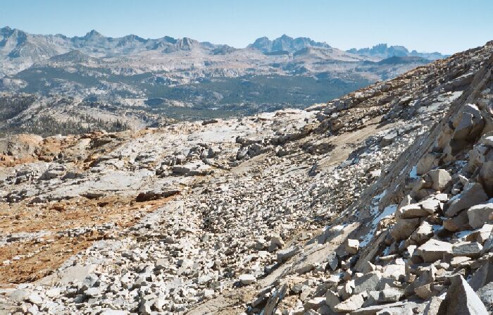
The jagged teeth of the mysterious Minarets are on the right horizon, flanked by Ritter and Banner peaks. This image also looks towards Post Peak Pass.
Looking North from Red Peak Pass
The Ottoway Lakes Loop, September 2004The trail tops out in a narrow col on a knife ridge, and you only have to go a few paces north or south to see either view. Looking south you have a good birds eye view of Upper Ottoway Lakes, parts of Merced Peak, its ridge and the rolling hills of southern Yosemite. Once again you have to marvel at the mixture of reds and grays in this beautiful view. The bigger payoff is the northern view. Stretched out before you is the Cathedral Range and the highest peaks in Yosemite. Mt. Lyell is over 13,000 feet, and all of its nearby mates, from Mt. Florence to Foerster Peak are over 12,000 feet. Off to the right are the jagged teeth of the Minarets crowned by Mt. Ritter, which is over 13,000 feet.
The view from the pass looking generally north. Down in the wooded area below, I could see a lake, and just above it, Cony Crags above the Merced River valley beyond. To the bottom left you can just make out the trail switchbacking. The trail eventually heads for those small tarns to the mid-right. Mt. Florence begins to rear up on the right edge of the image.
Below, the whole Merced River drainage was stretched out before my feet. In the distance you can see as far as Mt. Conness, a peak I have visited. Near at hand the landscape is a bleak and treeless combination of red, gray and white rock, but below you can see the upper reaches of tree-line reaching up from deep forests below. The Merced River canyon was an obvious gash below heading to my left. All in all, a very impressive sight.