The Ottoway Lakes Loop

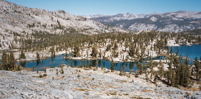
The left bottom corner gives you an idea about the footing on this cross-country route. Look beyond Red Devil Lake on the left side, and you can see another lake in the shallow valley beyond. The Merced River trench can be seen in the distance. I headed for about mid-picture shore. There was a small burn to the right, but it was not much of a burn.
Cross Country to Red Devil Lake
The Ottoway Lakes Loop, September 2004 I do not recommend this cross country route from the trail near the upper lake to Red Devil Lake. Rather, I would suggest following the trail east to its northern most point where it begins to head south (above the small lake at 9911 feet), then head northwest cross-country to the eastern shores of Red Devil Lake.
The travel around the lake was excellent. The is looking north. My kind of lake! I really wished I could have spent a day or two here exploring the whole area. Keep that in mind for your own trip.
I followed a grassy joint downward, which narrowed and became a little tricky to navigate. Nothing too hard, but something to think about if you are alone. After a while I left the joint for more open terrain, which turned out to be broken ice shattered dark slate rock that could prove unstable in steeper terrain. My goal sort of disappeared in the complex terrain, but after steady progress I reached the last obstacle, a steep broken face. It was just a matter of picking my way down through loose rock till I found a convenient ducked route to follow the rest of the way down. Not too bad, but I know now there are better ways to get to the lake.