The Ottoway Lakes Loop

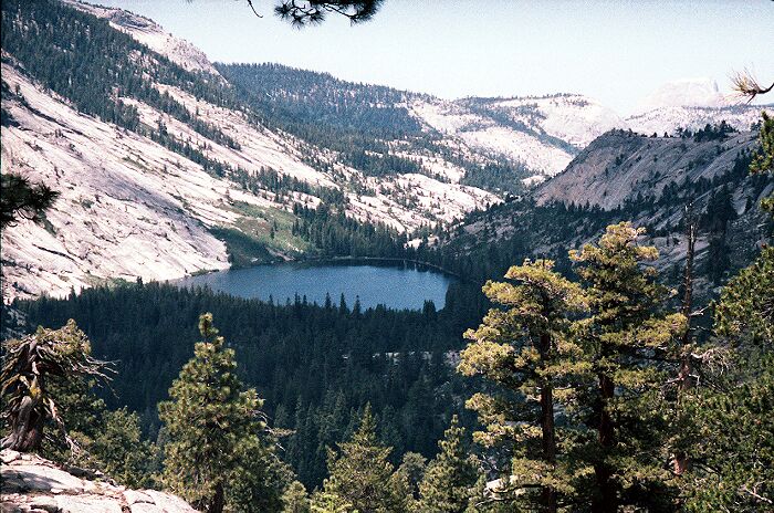
The hiking was easy, and even easier due to the fact I had knocked down four days of food, which was about five pounds of food. It makes a difference. The trail was in deep forest and slightly downhill till it broke into the open near the High Sierra Camp (HSC). Off to my right on a granite knoll was a big solar panel array that I would later see attached to something in the HSC. As the camp came into view I knew I was now in non-wilderness designated land.More than 10 years ago I took this picture from above Merced Lake. Beyond the white dike just below the lake is the High Sierra Camp. Somewhere below to the left in the forest is the Ranger Station. You can just make out the looming monolith of Half Dome on the right horizon. A nice area to visit to be sure.
Merced Lake
The Ottoway Lakes Loop, September 2004 Day 5 September 26: Merced Lake Ranger Junction to Little Yosemite Valley. 10.3miles, 1423 foot gain, 2607 foot loss, (H->9.9m). Special Note: From here on out all the pictures are (mostly) from a trip I made more than 10 years ago (not that things have changed much). For example, the picture above is an older picture, and the one below is a new picture. Anyway, an older camera, an average lens, and processing that is not near as good as today, while I try to make up for deficiencies with a lot of digital software tricks. That is what I have to deal with.No doubt about it, that was a cold night. I woke up at about dawn and stayed in the sack for a while till the light was fairly strong. I put on nearly all my clothes and packed up. I had read other trip reports where others had bear visitation at that very campsite, but I saw no sign of them other that the already clawed trees. I looked for footprints, but I saw nothing.
About the time I was cleaning up breakfast, the sun made a surprise appearance (being in a canyon and all) and rapidly warmed things up. Around the time I had to leave, I emptied the waterbag into the firepit making sure it was all the way out. It was a very forested area, so I made sure (as usual) there was no chance for a fire starting from my campfire remains. I left only footprints behind and made more on the trail.
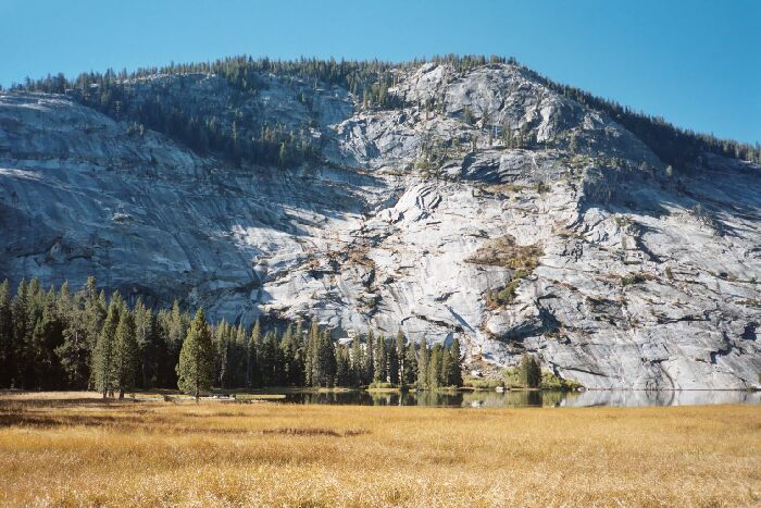
 Early morning light on the east end of Merced Lake.
It seems I always arrive at these HSC's when they are shut down, except when day-hiking near May Lake. Everything was locked down and boarded up. The tent platforms were just a collection of flat spots with some support bars lying in the ground. The bathrooms were locked.
It was a nice area, with the main trail skirting the HSC to the west, with another connector right through the center of the HSC. There was a low arm of a granite ridge just to the west of the HSC, which probably provides something of a windbreak for the camp. The camp was mostly open with a grove of trees to the north.
I followed the western trail past the camp and entered a large developed backpacker camp with multiple fire rings and some people. It also had some toilet buildings! Cool! So I went over and…they were locked! Hey Rangers! There is no off season for bowel movements!! Geez…
I headed back for the trail and took care of business later. Yeah. Like you needed to know that….
I short walk down the trail brought me to Merced Lake and a view…almost exactly the same as Washburn Lake. John Muir said that Nature was never so stingy as to make only one of any nice thing and Merced Lake was proof of that. Merced Lake had a slightly cozier feeling to it and the granite to the left (south) side of the lake looked perhaps cleaner and a bit more picturesque. The fringe of the lake was also perhaps a bit more decorative, but overall, the lake was a twin of Washburn Lake. Maybe it did not get as windy there. Certainly, it probably gets more morning and evening light due to is east-west orientation.