A Solo Hike Along the Silver Divide
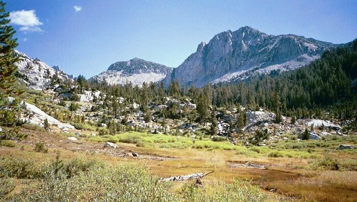
Looking towards Mott Lake. To the right is the canyon of Blue Jay Lakes . The higest crag there is point 11771.
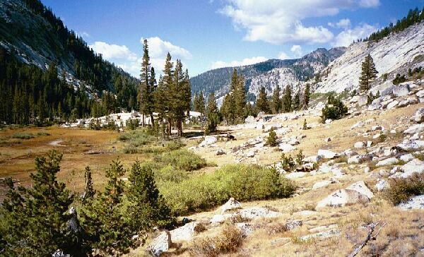
Another High "Pocket Meadow"
Silver Divide Trip from Edison Lake Trailhead, August-September 2001
After the stream crossing, the trail continued upward at a more pleasant rate in a more open environment that allowed me to see the views that were all around me. That first section had been fairly densely forested.
After a bit of hiking, I reached yet another small "pocket meadow" of the high altitude kind. It was exposed enough so that some sun loving desert plants grew there, along with the usual assortment of small trees, bushes, and a large sward of meadow grass. I do not doubt there were plenty of Shooting Stars growing in the meadow earlier that season.
Looking back down the canyon of the North Fork of Mono Creek.
The "U" shape of a glacier canyon was evident there at the meadow, proving as Muir said that even after such smothering destruction as a glacier, beauty can follow.
After the meadow, the trail reached steeper rockier ground, now exposed to the strength sapping sun. This sections was mainly a trudge with the occasional tree to keep me company. This last section turned into one of those "When the heck do we get to the top and to the lake?!" things. But eventually, the top was reached, but not without a fair amount of sweat.