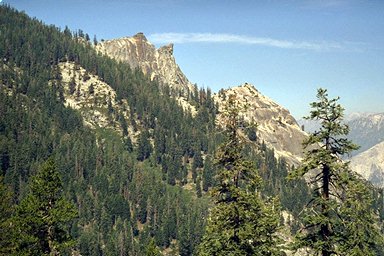
Sphinx Lakes in Kings Canyon

At last you draw above the Sphinx and think about the hike out to that granite monument. Someday maybe. Maybe.
The Sphinx
When the trail at last enters the forest in the upper reaches of the canyon, the rocky horse-steps are behind you and the trail takes on a more "normal" aspect. Also, a campsite is located below close to the now nearby Sphinx Creek. Leaving the creek behind, the trail sweeps back and forth in long lazy well-graded switchbacks, at last allowing the hiker a rhythm and steady pace. On the last leg of switchback, the climb becomes gentle, and meets a noisy creek, above which are campsites.
Now the trail angle becomes shallower and shallower until at last you are actually losing altitude. At this point it is about ¼ mile to the Sphinx Lakes and creek junction, and you can look down on the hatchet shape of "The Sphinx" as well as nearby spires and peaks. As you approach Sphinx Creek you will enter a forested meadow area. After crossing the creek the trail becomes somewhat indistinct although there are trail signs here and there. Those going on to Avalanche Pass will perhaps have to consult a map and compass and search for the trail. There is ample water and at least two campsites but no bearboxes, although the presence of a nearby large Avalanche Meadow up canyon and claw-marks on the trees almost guarantees the presence of bears. If you stay, hang your food well. More of a pest will be mosquitoes, so consider finding a camp away from the wetter areas.
On average it will take about 6 hours to get to the Sphinx Lakes junction from the trailhead. A trail sign says there is an un-maintained trail to Sphinx Lakes. Later you will laugh at this fiction. If you stay the night, later you will see impressive lofty alpen-glow gold-bathed peaks towering up-canyon.
At this point you have gained 3500 foot over about 6.8 miles, and reached 8500 feet.