The Grand Canyon of the Tuolumne and Falls
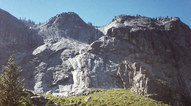
Just before getting to the Muir Gorge area, we were treated to another set of waterfalls along the south wall, cascading down sheer granite faces. White frothy water falls down the granite face mid picture. Three falls can be seen here. There are no mapped names for these falls.
Register and Rodgers Creeks
The Grand Canyon of the Tuolumne and Falls, June 2004A hot nearly mile and a half and 500 feet of gain with little shade brought us near Rodgers Creek. The views were still pretty grand, especially along the granite walls to the south. More waterfalls graced the walls and gave reason enough to stop for a look and a picture or two.
The canyon narrowed again as we drew near Rodgers Creek, and then climbed nearly 300 feet to the bridge. At last there was a bit of shade here and there as we closed in on the creek crossing. Still, it was not as hot as it was going to be up ahead. As a matter of fact, it actually cooled a bit as we entered the area of Tuolumne River rapids and creek falls.
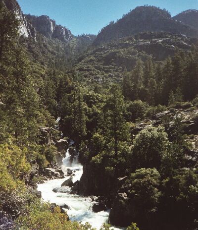
Looking up towards the Register Creek cut, from where the Tuolumne River narrows down to rapids. You can see by the vegetation that we are still firmly in Transition Zone at ~5050 feet.
We crossed Rodgers Creek on a bridge: good thing too because it was a pretty spectacular steep cascade. Someday I would like to visit Rodgers Canyon and spend a night at Rodgers Lake (a picture of that lake can be found in my Benson Lake Loop story). Now I have been at the headwaters and end-waters of the Rodgers Creek drainage. I would like to see the rest.
After the bridge came the wet crossing of Register Creek. The trail moved into a shady cool area and arrived at the creek in a very nice grove with great places to set down gear and get into stream crossing shoes. We could tell that the crossing would be trivial after all (we had wondered how hard this crossing was going to be early season). The weird thing was we could not tell where the trail was on the other side. We would have to cross and find it.
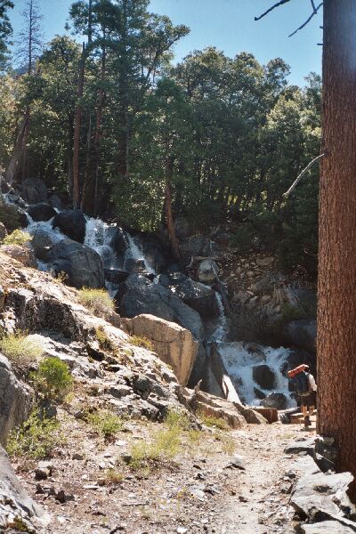
Dave is about to cross Rodgers Creek bridge, but ahead is a wet crossing of Register Creek.
What we did not know was that we had climbed about 300 feet over the last 1/2 mile, and that was only part of a hot 1500 climb and 1000 foot descent that would only nets us an actual 500 foot gain.
Once we crossed the river, we found the missing trail (in poor condition) which climbed rapidly up the shaded slope. Continuing the steep climb, the trail broke out into the open in a pretty rocky saddle near Point 5637. Here we parked our packs to climb Point 5637 and see Muir Gorge.