Mt. Whitney From Cottonwood Lakes
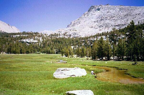
Dave is cooling his heels in Whitney Creek, and soon after taking this shot I joined him. The opening of the canyon holding Crtabtree Lakes can be seen left of center picture. To the right is the ridge of Mt. Chamberlin
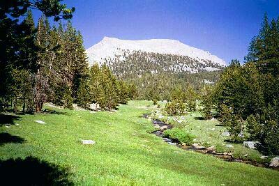
Crabtree Meadow
Mt. Whitney Trip from Cottonwood Lakes Trailhead. June 2000.
At the foot of the switchbacks at last, I found myself on a flat grassy area and arrow-like trail that I followed to the large open green meadows of Crabtree. What a contrast to the previous six miles! Mt. Whitney and it companions loomed large above the green lawn expanses of Crabtree Meadows. A canyon yawned nearby inviting a look at Crabtree Lakes. Small trees studded the rocky granite terrain surrounding the meadows, and nearly ideal camps were scattered nearby with spectacular views that would only be enhanced by the sunset alpen-glow.
Unfortunately, our camp waited higher up, and was hopefully above the pesky mosquitoes. After barefooting the ford of Whitney Creek that was something of a relief for sweaty, dirty, aching feet, we had a protracted rest near another ideal campsite, where we ate, bathed our feet in the meadow stream, and generally hung out sunning ourselves on the convenient slabs and rocks. Life was good.
The trail from Crabtree Meadow follows the creek.
Eventually we had to suck it up and head out, our plan being to get high into the drainage for a good kickoff point for the assault on Whitney the next morning. The sooner we could get into camp, the sooner we could rest up for the day ahead, and we were not getting younger hanging out by the meadow. Reluctantly I heaved back on my pack and headed down the trail, leaving the Shangri-La of the meadows behind.
Normally, those people who must pass over Trail Crest and down into Whitney Portal in one day, try to get as high as possible and camp. This means they shoot for "the tarns" above Guitar Lake. We intended to return to Cottonwood Lake (despite what our permit said), with Whitney Portal being the escape route only if for some reason we were delayed. We were right on schedule (will wonders never cease?), and already in good position for the hike up Whitney. We really did not need to get as far as "the tarns", just near enough for an "up and back" hike.
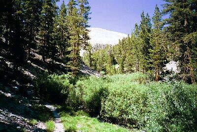
Young Whitney Creek tumbles along a park-like expanses of green lawn. The area is nearly ideal. Mt. Young glows starkly white on the horizon. Can tree line be far now?
From the meadow the trail began level enough, then began to follow the stream upward on a fairly gentle grade. The stream was in a wide trough it had cut some 20 feet into the surrounding forest. We would later see other hikers coming up this trail huffing and puffing, but it really is a gentle climb. The trail passes other meadow areas and in one narrow defile crosses the stream on rocks, a wet and swift crossing early season that may be bypassed on another trail to the west: after all you were on the correct side of the stream to begin with. Eventually we reached the junction that forked to the old trail found on the 7.5 maps that now served as the trail to the Ranger Cabin, and the left fork that took us back along the main trail over the stream on logs and rocks.