Mt. Whitney From Cottonwood Lakes
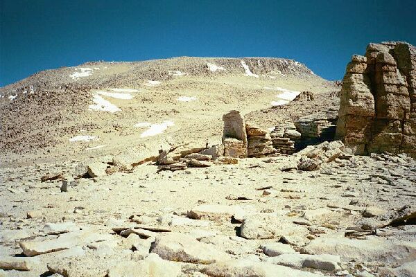
There is Mt. Langley. The use trail goes to the rocky right, while the best and easiest way is around to the left below the snow patch seen on the left. I went as far as the snow patch on my hike. Note the interesting rock monoliths on the near right.
Mt. Langley
Mt. Whitney Trip from Cottonwood Lakes Trailhead. June 2000.
At first the trail was steep and sandy, but once it topped out it became a gentle and pleasant walk. The trail, treaded, faint and non-existent at times, would be more of a challenge to those not acclimated, but I was thoroughly acclimated by that time and I was enjoying the tour through the strange rock formations the trail wove through. After passing through a fairly level area I found myself on the sloping shoulder of Mt. Langley where the trail began to climb once again. Haste was not an option, but a steady pace and proper breathing made for good time. At one rest point the trail split and I was torn between the two. I was following Dave and his new found friend and it was their excursion for which I was merely a tag-along, so I followed their tracks, which eventually bypassed a large snowfield. At a level spot where a large bench of rock made for a great rest stop, I watched Dave heading north for a saddle below the summit. Actually I was convinced the most used and easiest trail to the summit was to the left, but it was their show. I waited for some sign they had actually found the correct route to the top, and eventually Dave signaled he had found the way. I began the long trudge to the saddle, taking pictures along the way. At the saddle the "trail" leapt upwards among large talus and boulders and after climbing up a ways after the other two I decided it was too much effort for a wild goose chase. They were attempting to cross a very steep snowfield and turn a corner when I called up to them to shout down to me if they found the correct route or not and I went down a short ways to await their answer. And I waited. And waited. I was afraid to go and miss their message and I did not want to go up to what I thought was the more correct route by myself (it was), so I waited some more and had a snack break. After a while and after shouting after them I gave up and decided to go find the correct route down the ridge.


