The Benson Lake Loop
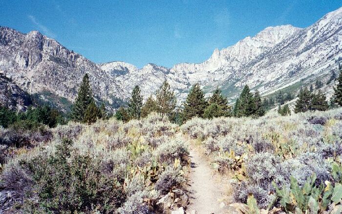
The view up canyon after you break out of the trees into the open. This is an example why I love the east side of the Sierra. A beautiful mixture of desert plants and alpine scenery. A nice view of the Sierra crest.
The Benson Lake Trailhead
The Benson Lake Loop, August, 2002Most guidebooks that have this hike recommend doing this loop in a counter-clockwise direction: Going to Peeler Lake first then to Benson Lake and around. After careful map study, looking at the altitude gain and loss and doing the actual hike, I have to say the best way is the way I went in the description below. It much easier on the body, the trails are better to tackle in my direction, and the enjoyment of the trail is greater. Going the other way too often delivers the hiker to the best points of interest exhausted and worn out. For example, the first day, it is about the same altitude gain to Crown Lake or Peeler Lake, but the last part of the Peeler Lake trail is a Sierra roller coaster with steep switch-backs and altitude loss that would be very annoying and tiring to the weary hiker. Getting to Crown Lake is much more straightforward. The second day going my way would require going over Mule Pass (but only a half-day of hiking to get to camp). It is only about an hour and a half or less of hiking from Crown Lake to Mule Pass and after that there is only one more steep (but fairly short) hike out of Benson Lake. Go my way: it is a lot more fun and less strenuous than going the other way.
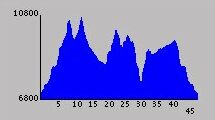
This is the trail profile of the entire trip. Benson Lake is the lowest point while Mule and Burro Passes are the high points. As you can see, it is a little over 45 miles. I did about 50 miles all told counting the side trips. A nice distance and hike.Day 1: Thursday, August 29th, 2002, 7.5 miles, 3000 foot total gain.
After spending the night near Sonora Pass above 9000 feet, I was at the Ranger Station before it opened. After getting my permit (no bear canister required: yes!), I headed for Twin Lakes. The drive was a good one, particularly by the lakes. The scenery was unexpectedly good with the sparse forest covered high moraine walls sheltering the lakes. With a little altitude gain, all of Bridgeport Valley sprawled out before me, backed by high mountains. The road officially ended at a resort crowded with about a billion huge RV’s. Past a restaurant was an obvious toll and information booth, so I bought my parking permit, parked and assumed the load.
Guidebooks warned it was not easy to find the trailhead, and while it was not hard, it was not obvious. Following red symbols on the trees, you walk fairly straight and level, ignoring side roads. When the road splits, look to the left front beyond the left fork and spy a meadow. That is the correct road.
Another long walk by meadow and campsites brought me at last to a sign (just before a bridge) that marked the correct trail.
Looking back down canyon you get a great feel for the glacier that once called this place home.
More forested level trail finally moved right and began an easy curving climb. More long straight trail that was sometimes level, sometime climbing a bit: the trail eventually brought me to the first of several open stretches. One of the highlights of this trail is the hanging valleys and glacial canyons that debauch into the main canyon. One of the more interesting canyons, due to the fact that several places along the trail you can see up into the canyon and spot the use trail, is Little Slide Canyon and its route to "Ice Lake Pass". The logical place to head that way is to leave the trail at the Hoover Wilderness sign along the trail.