The Benson Lake Loop

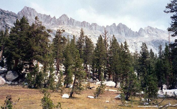
In the Piute Creek Canyon, I began to get some close up views of the Sierra Sawtooth Ridge.
Piute Creek Canyon
The Benson Lake Loop, August 2002Back on the trail the first thing I noticed was the trail was in very poor condition, not to mention very steep and sometimes tricky. Later I was to learn from someone from trail crew that they neglected it because of "lack of use", while lavishing attention on the PCT. This seemed wrong to me due to the number of people I saw on that section: not many, but not exactly low use. Funny that they should concentrate on the PCT when probably its peak PCT use was when there was a good deal of snow on the trail keeping feet off the trail itself. Meanwhile, the trail was in very bad condition, unusual for a National Park. Sometimes it was better to stay off the trail itself and walk besides it. Other times it was faint but not hard to follow.
Finger Peaks above the infant Piute Creek and canyon.
This trail segment also seemed not to be able to make up its mind where to go, and at one point climbed up a ways to find a gully and narrowly descend its course. Eventually the trail found the mouth of Little Slide Canyon and a broad grassy flat to cross before it found the forest edge of the valley below. I could see that this area held excellent and easy cross-country travel. Once in the forest, the trail worked its way downward towards Piute Creek.
This is just about the best view I got of "The Slide", which went from right to left.
Through the trees I could glimpse "The Slide". Now I know that anything that is big enough to show up on a 7.5 map and take up a small part of it had to be huge. "The Slide" is monstrous. My guess it came down in the same quake that John Muir experienced in Yosemite Valley, for the slide was the stark white of newly broken white granite. Muir guessed that earthquakes formed the talus heaps of the Sierra.
The huge mass of "The Slide" came down with hideous force, burying the valley below with what looked like 50 feet deep and a half mile wide of mammoth granite blocks that crested far up the opposite canyon wall. Above the slide a swamp, not a lake, formed: the slide was too porous to hold back the waters of Piute Creek.
The trail weaved downward and eventually leveled out. The guidebooks say there is a trail and a sign for a stroll down Slide Canyon, but I saw no such sign or trail.