The Benson Lake Loop

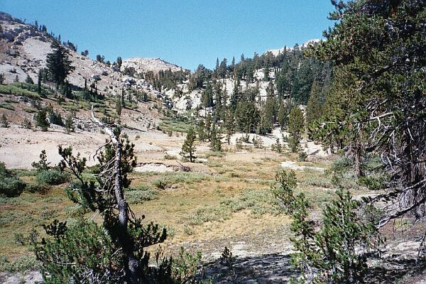
After the meadow switchbacks, the trail breaks out into the sandy open. This is looking towards the pass, unseen here, at mid horizon.
Heading Towards Benson Pass
The Benson Lake Loop, August 2002
Back on the trail, the level stretch over the meadow ended at the bottom of a set of switchbacks that I found to be arduous, steep and near viewless on a tree covered steep slope. But just when I thought it would never end, a surprise. Looking at the map, you would never guess what was coming up. At 9800 feet the trail burst out of the trees into an unusual area of meadows, groves of trees, a deep bare ravine, and barren rounded slopes to the south. The trail seemed to wander around this large sandy vale, passing through a pleasant copse of trees before reaching the lower end of the next steep section leading to the pass. It was a pleasant walk through the park-like surroundings, which was nice because the next section was not so nice.Benson Pass is just ahead...sort of. There is still a little ways to go to get to the pass, still out of sight here.
The next 200 feet of climbing to the pass was nowhere near as hard as the major passes of the Sierra on the PCT, but still, this next section was no great joy. The trail was exposed, sandy and steep, pretty much a slog. Looking back to the "park" below on breather breaks was nice, and as I neared the pass, views began to open up to the east towards the Sierra Crest. Slogging on, I kept thinking I had reached the top of that thing, when actually I was just reaching a false summit, and there was more to go.