The Benson Lake Loop

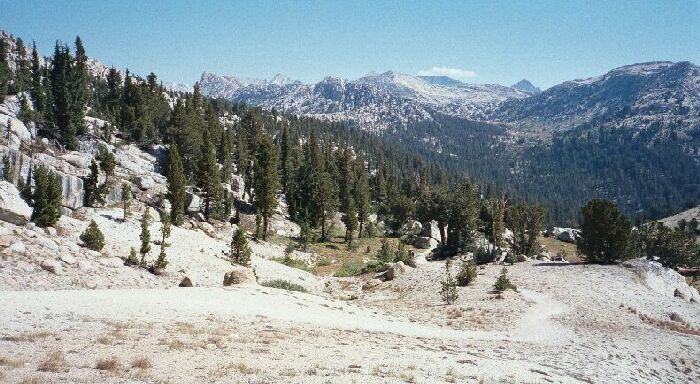
The sandy trail-slog finally levels off at Benson Pass after climbing out of Wilson Creek Canyon seen below. The Sierra Crest can be seen on the horizon.
Benson Pass
The Benson Lake Loop, August 2002
Finally the trail gradually leveled out in a most annoying way and reached the broad flat pass area (~10,121 feet) between sandy hills and cliffs. I dropped my pack like a sack of bricks and grabbed my camera.Looking to the east I could look up the Wilson Creek drainage to Doghead and Quarry Peaks, and beyond to the Sawtooth peaks on the Sierra Crest. It all looked like inviting country to explore. Benson Pass was no Burro or Mule Pass, but it was still nice to be there with the pleasant views and knowing it was mostly downhill all the way to Benson Lake.
Benson Pass with Volunteer Peak seen beyond.
Back to my pack I found a nice platform to the left of the trail summit that gave me an excellent view to the west, and provide me with a good place for my chair and lunch. The view was less engaging than that of the eastern view, with the most prominent and interesting point of interest being Volunteer Peak. Mostly below was a "V" shaped tree-shaded ravine that the trail marched up, with the last trail section guaranteeing the hiker from the west a gut-wrenching steep sandy log up the last switchbacks before the summit.
It was not noon yet, but I did not mind getting first lunch taken care of before taking on the next drop of 900+ feet down the trail to Smedberg Lake. Soon enough it was time to sling on the load once again and head out down the steep trail.