Circle the Cirque Crest

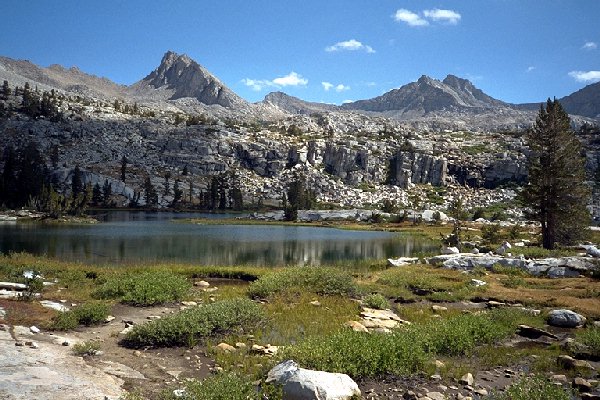
At Lake 10,592 looking ENE, at treeline. The easy cross-country is apparent, especially with a trail through the rough parts.
Lake Basin
Circle The Cirque Crest - By D.W.Donehoo (All rights reserved)
Day 6. Thursday, September 4. The nights were far more cool and comfortable now. We woke up ready to explore Lakes Basin, and we were soon out of camp. The Lakes Basin was probably far more visited in the past because the John Muir Trail (JMT) used to come up Cartridge Creek and cross Cartridge Pass. Someone must of decided the area was far too beautiful to have a maintained trail through it and mandated a trail over Mather Pass to bypass this beautiful basin, which would undoubtedly be as popular as Rae Lakes Basin, had the trail stayed in Lakes Basin. Well, perhaps not: it is far from any trailhead except Taboose Pass, and that pass is an epic journey in itself. Horses on the other hand... Still, its hard work to get there, and still would be if it were on maintained trails. As you will find out later, a maintained trail would not make the journey into the basin much easier.
Cartridge Creek drainage from near Marion Lake
The Marion Lake trail led out of camp to Cartridge Creek. Once across, you have two choices. You can follow the stream on easy cross-country up to the lakes just above and find the good trail up a gully to get to the lip of the basin, or you can try to find the old John Muir Trail. We decided to find the trail, and finding the trail is the hard part. Map in hand with the track of the old JMT carefully penciled in, we climbed then traversed through the mature forest and did indeed hit the JMT. It was not much of an improvement over cross-country, with its few switchbacks and steep climbing. Eventually it crested the lip of Lakes Basin and fairly faded away, and we lost it altogether. No matter, because cross-country in Lakes Basin is mostly Class 1 walking: all you need as a map and compass. Our goal for the day was to check out the approaches of Dumbbell Pass and Cartridge Pass and see the sights.
From Red Pass we had seen a large open meadow below in Lakes Basin, so we headed in that direction, and eventually reached the northern-most lake in the basin where we stopped for a snack near some stunted trees. This lake was fairly exposed, but pleasant. Not a camping candidate with the better choices nearby.