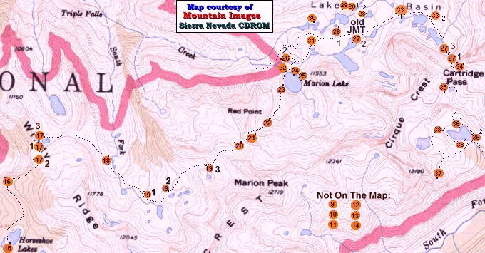
Click on a numbered location on the map to see a picture and text, or start your "hike" of the trail in the proper sequence by pressing "Next" below. If you are using the map, after you click on a location you will have to use the browser "back" button to get back to this map, otherwise you can continue the "hike" from there using the "Back" and "Next" buttons. The numbered dot is only the general location where the picture was taken. The black dot at the edge of the numbered orange dot is the general direction (from the center of the orange dot) the camera was pointing. If you are having trouble selecting the right picture, place the pointer a little ways from the dot away from the others and try again. Your browser should also note the link as it crosses it, and you can see if you have the proper link. For example, "Name27.htm" is associated with dot 27.
Warning! Sierra Trails looks best using Netscape maximized, 640 by 480 resolution minimum, (800x600 best) with your display set for 16 bit color or better! These pages should have a border around the pictures and the buttons at the bottom should be separated and centered. If that is not the case then you are probably using one of those "other" browses, probably an older version to boot.