Kern-Kaweah and Kaweah Basins

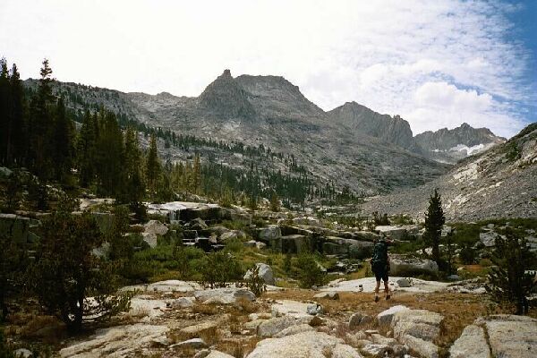
At the junction of two creeks the trail crosses the creek (twice!) in an area of small falls and cascades. The turret above overlooks Colby Lake to the left (well out of sight at this point). Down canyon is Triple Divide Peak.
Creek Junction
Kern-Kaweah and Kaweah Basins via Colby Pass, September, 2000.
The trail climbed mildly in the park-like area before leveling off to twist to the right over open granite to reach the river and follow it to a rocky ford. Here I decided to get a bite to eat, some water and a short rest while Dave decided to forge ahead up the trail. Overhead, clouds were beginning to take over the sky from the east and south. It seems that when we experience unusually hot weather at the higher altitudes, it meant rain was sure to follow. I hoped it was not true in this case, but I had my doubts. Meanwhile, I was enjoying the area, and it really deserved a rest-stop for the views. The area of the ford was fairly level and was the outlet end of a meadow area that was probably filled in and overgrown long ago when it was a small shallow lake.
The waters of "Talus Creek" and "Colby Creek" provide the resting hiker with a little water music.
Nearby were several small cascades and falls tumbling down granite stairs topped by a grove of tall straight trees. White granite turrets, peaks and cliffs surrounded this basin, a typical example of the pinnacle of Sierra beauty: the high Sierra basin. Peaks towered up-canyon and along the Great Western Divide well over 13,000 feet reaching far above the tree line I was now approaching. Ahead waited Colby Pass, no slouch among passes at 12,000 feet exactly. The only place that compared with my current location was a beautiful unnamed basin between White and Gray passes along the Sierra High Route on the Monarch Divide. It was a great day to be alive and in the Sierra.