Kern-Kaweah and Kaweah Basins
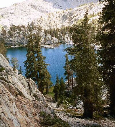
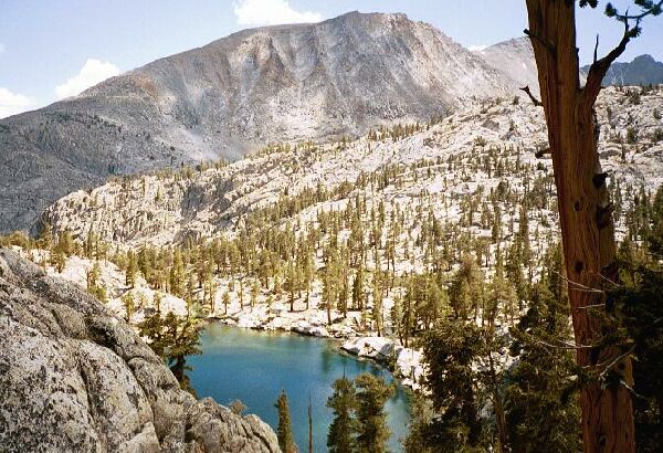
My view from the ridge above the lake. The picture below this one is generally the lower half of this picture.
Down to the Lake
Kern-Kaweah and Kaweah Basins via Colby Pass, September, 2000.
I finally reached top of the ridge and spent a few minutes trying to locate Dave. Following the crest of the ridge down a ways I ran into him and even more fantastic views of the area. The Junction Meadow was below, as well as the small dome the trail skirts to enter the Kern-Kaweah basin. Above that was the Wright-Wallace Creek drainage while above and on the right was Mt. Whitney, another destination we knocked off that year. To the left was Bighorn Plateau and framing the scene on the far left was Kern Point and Kern Ridge. Below us to the right was our early lunch destination of Doyle’s Lake. OK, so it’s not called Doyle’s Lake and in fact it has no name at all. But if they wanted to name it Doyle’s Lake, then that would be all right by me!
I hiked down an easy slope to this gully and the easy access to the lake below.
There were at least three ways to get down. Either descend on the left down the ridge, or straight down a bit to the right, or all the way to the right traversing a short steep safe slope to the right and then down to the left in a broad shaded gully, which is the way I chose.