Kern-Kaweah and Kaweah Basins
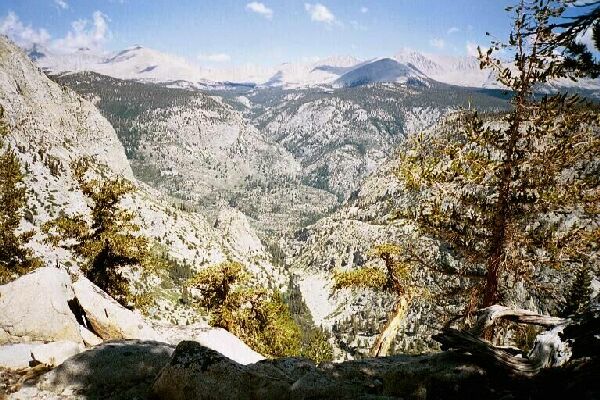
Down below is Junction Meadow where there is a level glen of giant trees shading nice camps. Above that is the obvious cut of Wallace Creek draining Wallace basin. On the right horizon is the Whitney Group and Crabtree.
Round the Shoulder
Kern-Kaweah and Kaweah Basins via Colby Pass, September, 2000.
We began making our way upward, and after four days at relatively high altitude, it was fairly easy. Here and there we sometimes saw game trail following this fairly natural route. The crux came at the shoulder corner of the ridge (It also afforded the very best view down canyon at that point, and I could clearly see the Sierra Crest and Mt. Whitney) where the way proved to be narrower and steeper. However the way was still obvious and safe and eventually it came to somewhat of a dead end. Looking ahead I saw we could make our way down and around to our goal, but a quick check of the map told me if I went up the steep slope, it would put us almost on top of the lake. The area was sparsely tree covered at this point providing just enough shade in the rising heat, and the soil slope I chose was threaded with game trail and perhaps some use patterns of other hikers, it was hard to tell for sure. Dave decided to stick to the stair-like talus for his ascent. I was both glad and sad I was not carrying my heavy pack up this steep climb. Without the rain, we would have had another stellar camp up ahead, but at that point I did not know that yet.


