A Backpack Cross-Country Traverse of the Minarets
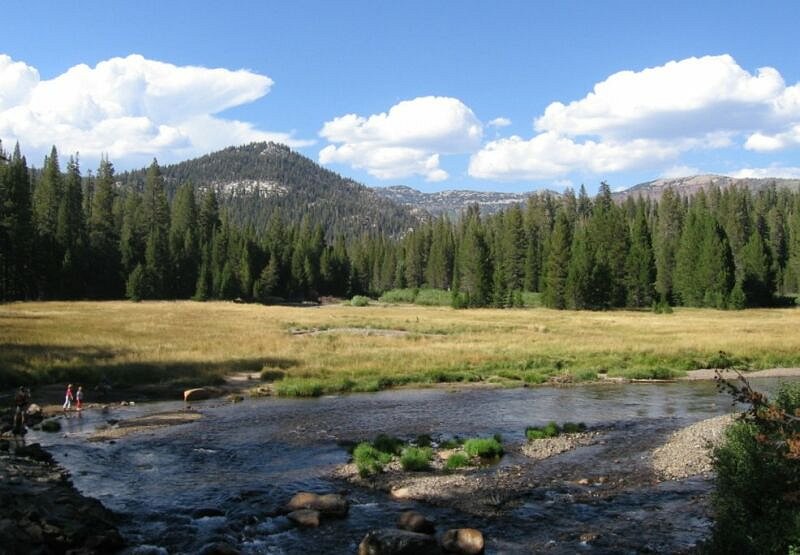
The Middle Fork of the San Joaquin River from the bridge not too far from the Ranger Station at the Devils Postpile. Already, it is a good sized river. But will any of that water reach the ocean? Most salmon would say "No".
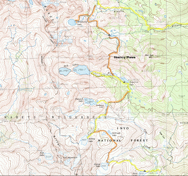
The Minarets Cross-Country Traverse
A Cross-Country Traverse of the Minarets, August/September 2006 A backpack cross-country mountaineering traverse of the Minarets. This hike traverses the beautiful Minarets using a combination of trails and cross-country routes.
The yellow lines are the trails that we used, and the orange lines are cross-country. This trip begins at the bottom of this map at Fern Lake (once you get there from the trailhead). Small triangles are camps.
Who Should Do This Hike?: Intermediate to experienced backpackers who want a fairly easy introduction to cross-country travel in the Sierra will enjoy this hike, and nowhere will you find a better cross-country experience. Beginners being guided by more experienced hikers will also do well on this trip. Nancy Pass is the point where only experienced backpackers in good shape will want to continue on due to the steep, rugged and potentially tricky nature of this true cross-country pass. Fortunately, this pass can be bypassed by going around on trail: a lengthily detour. The Cecile Lake cross-country section is another route only for the experienced. For much of this route, the book "Sierra High Route" by Steve Roper will be useful, where that route joins my route at Superior Lake.
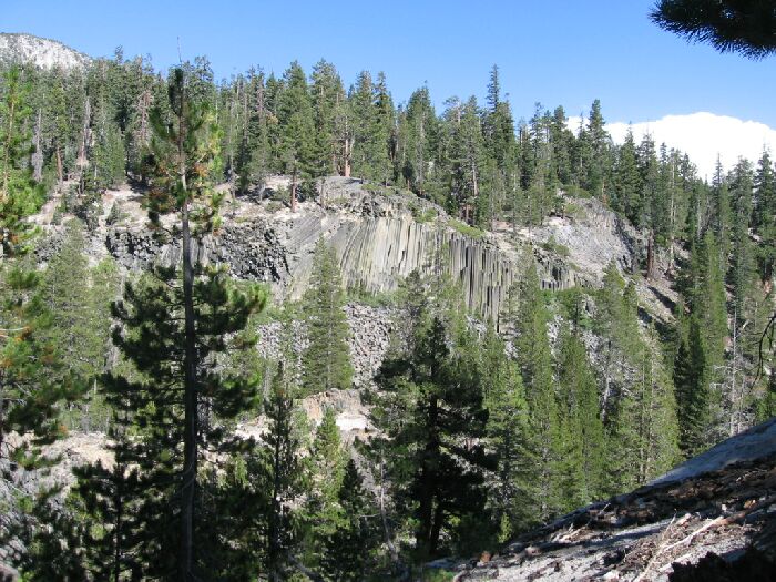
The Devils Postpile across the river as seen from the trail.
DAY 1, 4.5 Miles, 2163 feet of gain and 1045 feet of loss.
Dave and I left town somewhat early knowing that we had time to get to Mammoth in time to get a permit and hit the trail. After an uneventful five plus hour drive we had no trouble getting a permit and headed for the Mammoth Hotel to catch the bus. The bus ticket was purchased at a new (for us) kiosk at a newer higher price than when I was there last. Once again it was a slow-motion bus trip down to the Devils Postpile Ranger Station, featuring an excessively chatty bus driver that was so distracted that the next following bus caught up with him. Entertaining.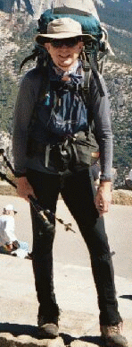
I was excited about this trip because I knew part of what was coming: for me, this was a finishing up of a trip that I started five years ago. For Dave, almost this entire trip was new for him, while about half was a part I had already done. I knew ahead of time this would be a spectacular trip and was pleased Dave would experience it. I was also interested because this would be my second trip with my new digital camera, and I had purchased some new gear that lightened my load and allowed me to carry a pack that was four pounds lighter than my main Dana pack. It could have been even lighter if we had left the ice-axes behind. The main reason my load was more manageable was that I had the new approved Ursack and would not have to carry the excessively heavy and bulky bear canister. Dave had a can, but it was a modern one that was almost as light as my Ursack. In any case, we saw bear scat, but no bears. Too bad.Your guide this trip.
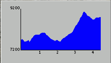
We hit the trail (finally) in the late afternoon, leaving the crowds behind at the Devils Postpile Ranger Station. Once on the main Kings Creek trail to Fern Lake, we did not see anybody else until we reached Fern Lake. It was 4.5 miles to Fern Lake, small potatoes in mileage for experienced backpackers, but with altitude gain and loss not to sniff at. Once we crossed the bridge of the San Joaquin River, the trail began its climb out of the river valley with nice views of the Devils Postpile. I was expecting this climb, but I failed to really look the gains and losses of this section of trail. The trail begins at about 7600 feet, climbs to about 8000+ feet, then promptly looses the altitude right back to about 7600 feet at Kings Creek. Kings Creek marks the halfway point to Fern Lake, and is the point where all of the altitude gain really begins. It is my understanding that in early season, Kings Creek is a wet maybe-dangerous crossing, but there are some logs and rocks upstream to help you get across. We hardly noticed the creek at all: it was just some stepping stones and small logs on the way to Fern Lake.The profile of the 4.5 miles from the Ranger Station to Fern Lake.