The Ottoway Lakes Loop
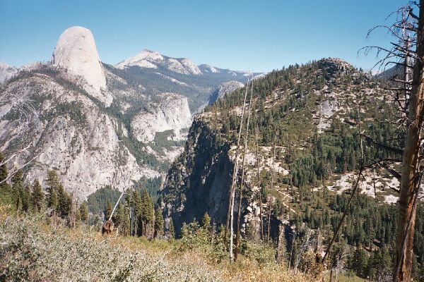
Half Dome looks more like a huge thumb at this point. Along Panorama Cliff, the Panorama Trail plunges down towards Illiloutte Falls.
Buena Vista Trail
The Ottoway Lakes Loop, September 2004 After about 1.5 miles I reached the Buena Vista Trail junction and took a right, leaving the crowded Panorama Trail behind. The trail continued to traverse the bushy open sunny slope, heading for the trees some distance ahead. Up ahead on the horizon, I could see one of the goals of the trip, the Merced Peak group, which I would reach the next day. My goal now, with my late start, was the Clark Fork with hopefully plenty of water. At the moment, I had a clear view nearly all the way up the Illiloutte drainage, with its sparse looking fire pruned forest cover with curious clear yellow sections. Domes could also be seen in this drainage as well as some sharp ridgelines.
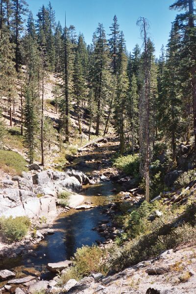
Illiloutte Creek along the trail. Not exactly a rageing torrent late season.
After about 2.5 miles, the trail leveled off near the Illiloutte Creek, and the trail took on a more expected Sierra roller-coaster personality. The main thrust of the Illiloutte basin is its rounded-off character. Everywhere you look everything seems sculpted to be round, smooth or flat, all owing the glacier that used to occupy that basin. The domes all around were all round and smooth, the riverbanks were round and smooth, even the stream seemed to go around smoothly through the valleys they occupied. All this added up to an exceptionally pleasant walk along the stream through the woods.