The Ottoway Lakes Loop
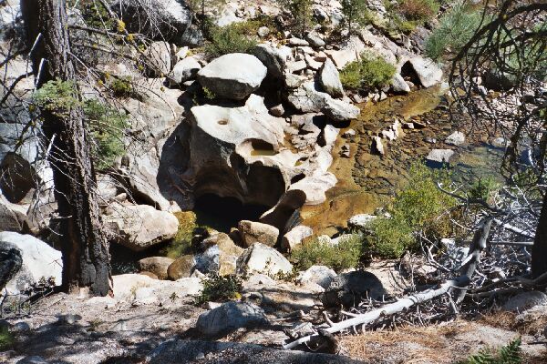
Looking down on some water carved rocks and pools. Note the large solution hole on the white rock. This must be something to see early season. Also note the burned trunk on the left from recent fires.
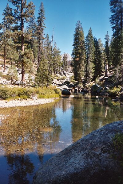
Mono Meadow Creek
The Ottoway Lakes Loop, September 2004 Mostly the forest was just dense enough to be open for views but allowing for some cool shade. Due to a brief storm that passed through the area a few days before (dropping six inches of snow in places), the day was fairly cool and the nights were always cold (sometimes below freezing). Each day would prove to be progressively warmer.
Mono Meadow creek is out of sight on the right. It is hard to imagine what this would look like with early season high water. The trail climbs over the little hill on the right, the first of real uphill for the day.
I reached Mono Meadow Creek, and while it was an easy crossing for me, I could see that early season this crossing could be a problem. Fortunately, one could go up-stream a ways and cross on large (round) rocks. The first really established camps were encountered near the crossing, although there were other primitive camping opportunities along the creek. Once across the creek, the trail climbs steeply out of the stream cut and resumes its gentle pace over a fire pruned open sandy plateau sporting new growth and recovering trees.
The trail again reaches a junction where I took a left onto the Mono Meadow trail. Almost immediately I came to a large developed camp site and the stream crossing.