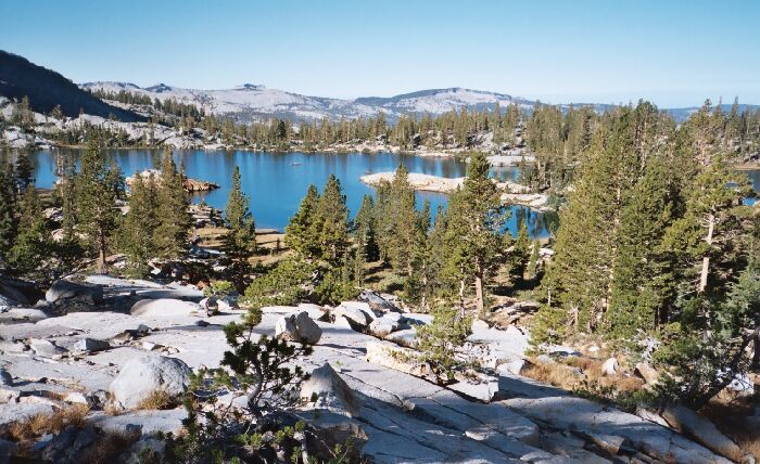
The Ottoway Lakes Loop

Buena Vista Crest and Horse Ridge hold up the horizon over Lower Ottoway Lake. The scrubbed white granite tells you you are in Yosemite and the view lives up to the hype. Note the island on the left. Looks like good camping down there.
Climbing Towards Red Peak Pass
The Ottoway Lakes Loop, September 2004Looking off to my right, I could see that if someone wanted solitude at that lake in peak season, the east side of the lake probably had a good number of secluded camp spots. Various small streams flowed through small pocket meadows protected on one or two side by clumps of fair sized trees. There were many stretches of level terrain and sheltering trees, so the area would al least be interesting to explore. I wished I had time to spend a day exploring.
The sun streams down on the exposed trail (left) as the trail heads to the base of the dark pyramid, where the trail takes a left. I am still on good well graded trail at this point.
Speaking of exploring, the area is significant because it was an area visited by John Muir. Muir says he camped "on the brink of one of the lakes", and from the narrative, it seemed to be Lower Ottoway Lake. It was there at Ottoway Lakes that Muir followed the outlet stream of Upper Ottoway Lake and to his surprise found glacial till in the water and stream. He followed the stream up to the lake and discovered his first Sierra glaciers below Merced Peak (much larger then). Later he put out a stake line on Mclure Glacier and measured the glacier movement, and had his proof that there were living glaciers in the Sierra, despite the claims of Prof. Whitney. That was a significant discovery.
The trail continued to gain altitude on mainly well engineered moderate switch-backs. That is on thing about Yosemite: the trails are mostly engineered to be moderate and easier that the surrounding wilderness designated national forest. For every hard section of climbing, there seemed to be a following level section to catch ones breath.