The Ottoway Lakes Loop

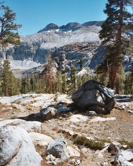
This is looking up trail towards Triple Divide Peak, seen here at left of mid-horizon. To the left of mid-picture you can see the glacier spillway that leads to the un-named lake (not barren) below Edna Lake (barren).
Merced Peak Fork
The Ottoway Lakes Loop, September 2004The trail meandered a bit before heading down into the canyon of the Merced Peak Fork of the Merced River. The area was remarkably park-like with a scattering of picturesque trees framing the peaks and cliffs of the Clark Range on the right and the far views to the left. The trail worked it way to the bottom of the canyon, took an annoying trip back up-hill along a joint and crossed the infant Merced Peak Fork of the Merced River.
This is looking down the Merced Peak Fork canyon of the Merced River. Beyond, Mt. Lyell and its companion peaks. At about mid-picture, you may be able to see a bit of blue from the lakelets along the river. A much larger lake is down canyon and begs to be explored, along with the rest of the canyon.
There are two interesting things about this point of the area.
First, if I had stayed the night at Red Devil Lake or Lake 9911, I would have been tempted (in the morning) to hike to the southern-most point of the trail near and west of Lake 9911 and struck out cross-country to the southeast towards the lake below barren Edna Lake and down to the trail to the east, following the young river. From the trail stream crossing looking back on this route I could see plenty of trees on the slopes near the lake below Edna Lake (not shown on the map), and I imagine there may be pleasant camping there. Additionally, the cross-country in the area looked very easy and the route finding easy.
Secondly, as I would confirm later, it is also possible to continue following Merced Peak Fork of the Merced River all the way down the canyon, passing a sizable lake, and meeting up with the main Merced Canyon trail. I imagine the large down canyon lake sported a camp or two for the adventurous backpacker.