The Ottoway Lakes Loop
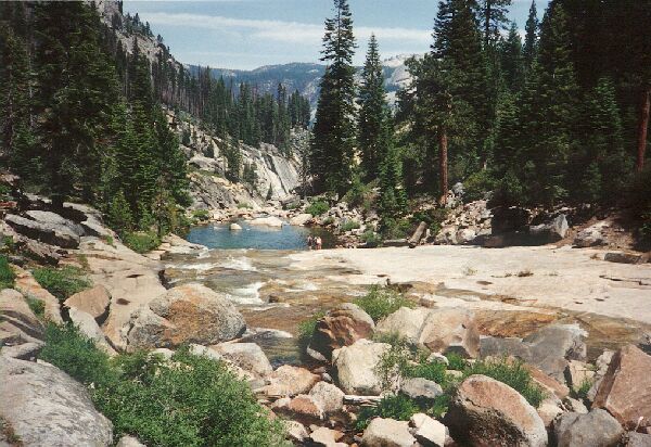
Below the bridge and trail, a huge slab forms the bed of Illiluette Creek. Below is the brink pool just before the drop into Illiluette Gorge.
Illiluette Creek Bridge
The Ottoway Lakes Loop, September 2004I took the Panorama trail after a short stop for refreshments, which for now was a mostly level trail for the next mile or so. The trail was a good one with many opportunities to stop and look at the wonderful view over Yosemite Valley. Many of the "Incomparable Valley's" major features were visible from the unique vantagepoint of this trail. The trail itself was rather picturesque, with shade and a scattering of well-placed trees to frame the broad views.
The trail made a broad switchback, which only served to prolong the enjoyment of the stunning panoramic views. Eventually the trail dove downward, and I came to a spur trail just off the Panorama Trail to a panoramic overlook called Panorama Point on Panorama Cliff. Makes you wonder how this feature got its name. The view from the point would thrill any acrophobic and the altitude just below my feet seemed unreal. From this point I was looking down 2000 feet to the valley floor. Watch your step: there are no guardrails there and the point actually overhangs somewhat.
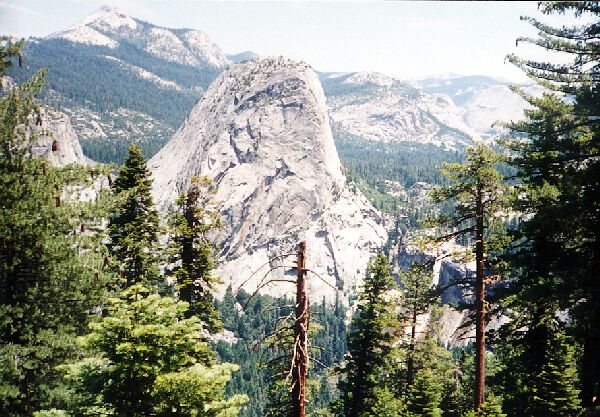 Liberty cap, Little Yosemite Valley and Clouds Rest from the Panorama Cliff Trail.
After the juncture, the trail really begins to lose the altitude and seems to take a long time to reach the bridge over Illiluette Creek. People going uphill can really appreciate the overall 800+ feet of gain to the trails highest point.
The bridge is a pleasant stop along the way, no matter what direction your are going. I stopped for lunch and watched the throngs of tourists herding by and the garden-like landscape. On the west end of the bridge is a very pleasant level shaded area perfect for lounging around out of the suns glare, with a sweeping view over Illiluette Creek. The creek sits on a vast sweep of solid granite and slides into a pool about 100 meters down-stream. For my lounging point, I could look upstream and trace the waters sliding and cataracting course down to the bridge and its further slide to the pool below just before the water narrows in a granite sluice and plunges over the cliff. Again, particularly in early season, respect the water and you will not get flung over the falls to your death.


