The Ottoway Lakes Loop
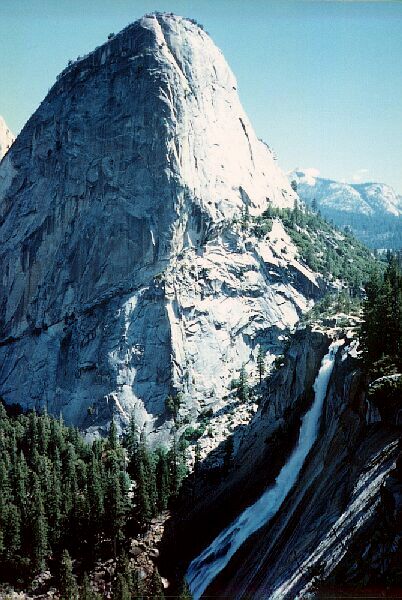
There are two connector trails to the Panorama Cliff Trail from the John Muir Trail (JMT). Near the eastern connector along the JMT is this view of Nevada Falls and Liberty Cap. Clouds Rest is among the clouds.
A Bit of the John Muir Trail
The Ottoway Lakes Loop, September 2004The trail climbed up a ways then leveled off. Just about the time it was to enter the interesting cliff trail with it great views of the falls, I met a spur trail to the Panorama Trail, which I took.
This next section is a shaded trail featuring a moderate grind of switchbacks that gain over 600 feet in elevation. The forest generally has a high canopy, which made for nice open environment with limited far views. Back and forth I went trudging upward, and it seemed to take longer and felt harder than the map would indicate, which seems to be the rule with Yosemite Valley trails.
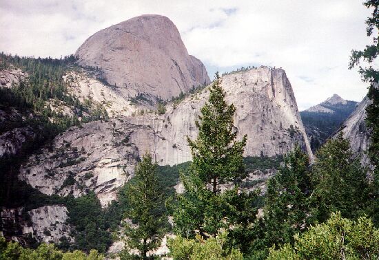 The back side of Half Dome. Mt. Broderick is right of center, and right of that is Clouds Rest.
Eventually it topped out at a cluster of iron Yosemite trail signs. Actually, if you wanted to do this Ottoway Loop hike early season and wanted to avoid the Illiluette, Mono Meadow and other stream crossings, you could hike up to this point from the valley and head for the Clark Fork on mostly level and downhill trail. There is a small matter of climbing 2600 feet from Yosemite Valley, and another 200 feet to the saddle to the southwest, 3000 feet of climbing in all. I suggest a stay at Little Yosemite Valley for a first day for that trip option. Another way would be to go from Glacier Point to the Panorama Trail, then to the junction above Nevada Falls and on to the Clark Fork. Longer but safer during high water.


