A view from the trail looking towards Volcanic Dome. I swear, that looks like a volcano cauldron the was sliced in two with only one half remaining.
Overlooking The Mono
A Pioneer Basin Trip from Edison Lake, June 2003Day 1: Trailhead to Mono Creek, ~9 hiking miles and ~2000 foot gain.
We hit the shore with the others, hitched up our loads and quickly found the main trail, leaving most of the hikers behind. The trail is fairly level with gentle walking on the well-used trail. Occasionally the trail passes through meadows on wooden walkways that are really taking a beating and will soon fail and break through. At this point we were above the main Mono Creek and its large riverbed, walking among some sometimes-massive trees. Before long we reached the JMT/PCT where it takes a left at a junction to go over a large well-made bridge over the Mono Creek, a wide swift torrent most of the year. The poor hiker going south would now be facing the dread Bear Ridge switchbacks, one of the harder sections of the JMT. We hit the north-bound JMT/PCT trail, still on fairly level terrain amid some forest giants. Before long, we hit one of major obstacles of the day, a tributary of Mono Creek. In early season it is an unavoidable somewhat swift wet crossing that is not particularly dangerous, but it is fairly deep, well past the knees. I have crossed it four times now, so I know. Still, one has to use caution and proper fording techniques. Hiking poles really come in handy.
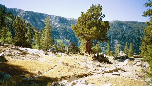
After the wet ford, there are switchbacks and little plateaus with fine views of the Mono drainage. Note the JMT/PCT trail to the right.
After the wed ford and getting our hiking shoes back on, we were back on the trail, which wound its way upward, up through switchbacks. The main feature of this section is short sections of well made and possibly over-engineered switchbacks topped with small open areas with nice views of the surrounding area.
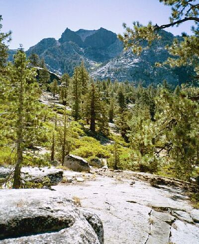
Do to the granite nature of the area, the views opened up, in particular towards Volcanic Dome above Bear Ridge. As we neared the trail junction, the forest closed in somewhat to shade the junction where we met a group of hikers who were on their way out. We took the south branch off the JMT/PCT highway, but if you want to know what is on the trail to the north, you will have to read the Silver Divide issue of Sierra Trails.
The view from our pre-lunch rest stop before heading up Mono Creek. This is looking towards VVR.
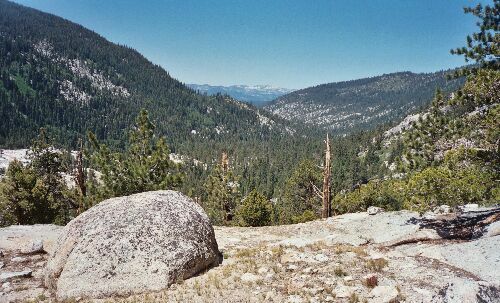
We reached a pleasant open little trail-summit area with a fine view down the Mono drainage towards Edison Reservoir where we stopped for a rest break and a snack. There were plenty of slab-granite places to walk to for different views of the area, as well as plenty of nice spots to unload and park it for a while. A very nice spot.


