A Short Trip in the Pioneer Basin Area
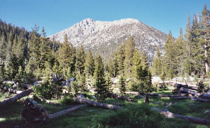
Mono Rock over the meadow below Third Recess. I saw no trail to Third Recess, though I bet there was some trail to be found in the steep parts above Mono Creek. The route up the Recess is obvious: just follow the outlet stream of Third Recess Lake on the east side. It is probably very nice.
Third Recess
A Pioneer Basin Trip from Edison Lake, June 2003
From Mono Creek Camp to Pioneer Basin camp, ~5 miles, and ~2000 foot gain.
Day 2:Like every day of this trip, the weather was perfect. As usual, we got up at first light. I remember being determined to stay in the sack till Dave was up and about because I was so warm and comfortable. But a sunny morning in the Sierra is too good to waste, and it is the very best time of the day. Everything in the morning in Spring seems so fresh and new, it would be a crime to not be out in the middle of it all.
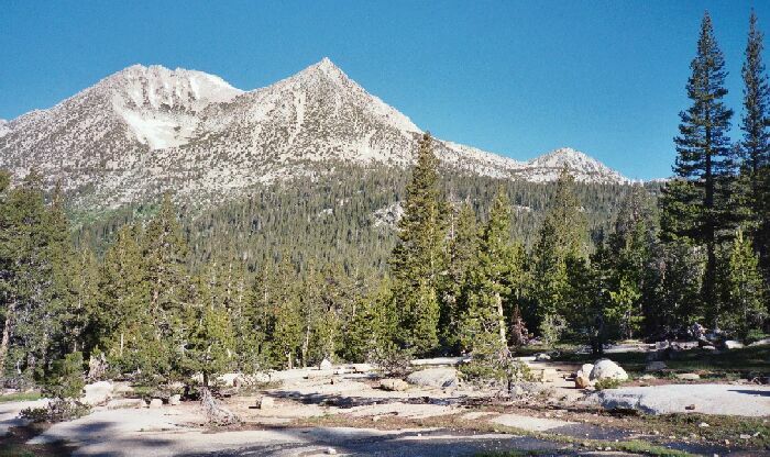
Mt. Hopkins from near camp. Note the prone trees felled and carried by snow avalanches.
It was not long before we were back on the trail and heading for our goal for the day, Pioneer Basin.
But there were a few obstacles along the way. The first one was Hopkins Creek followed by the fords of Pioneer Basin, all wet fords. One ford required some scrambling along the banks of the stream to reach a dual crossing featuring narrow logs. It may have been less nerve-wracking just to put on the wading shoes and wade across. It was not particularly difficult a wet crossing, even so early in the season and the morning.
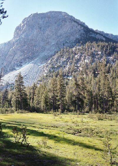
Peaks 12178 and 12967, which are to the west of Lower Hopkins Lake. Hopkins Creek Canyon is to the right. Actually, there is trail there on the rock if you can find it. This was shot in the trail section between fords.
Eventually to my relief, we got past the fords (not so bad) and reached the thickly forested trail junction to Pioneer Basin at a little over 10,000 feet. There was the usual heavy number of Lodgepole Pines in the mixed conifer pine forest at this section of the canyon, a testament to the more sheltered quality of the area. In many areas of the Sierra, 10,000 feet would be above treeline.
Taking a left at the trail junction, we entered an even more park-like area and beautiful trail that undulated along, actually losing altitude in a beautiful glen before beginning the actual climb towards the basin above. It was a pleasant climb that was not much steeper than the trail to the junction. At one point the trail crossed a small stream of a pocket meadow then climbed to the edge of the meadow. This was obviously a point where one could strike out cross-country to the largest lake of Pioneer basin, and I am sure along the way you could pick up the trail that is there. While I did see signs of camping activity, I did not see a trail. We resumed our climb upwards.