A Short Trip in the Pioneer Basin Area
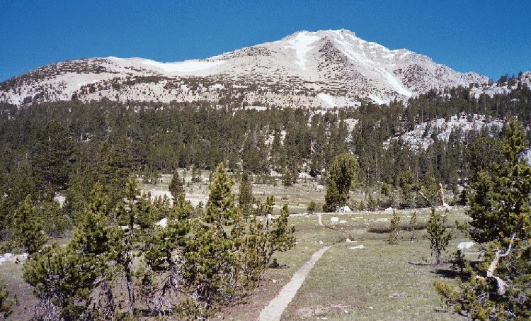
The trail approaching the lowest lake (10,393 feet, just ahead) of Pioneer Basin. The trail climbs the wooded ridge ahead and to the right to the next lake at 10,820 feet. Mt. Hopkins looks down on all near mid picture. Now this is backcountry travel.
Reaching Treeline
A Pioneer Basin Trip from Edison Lake, June 2003
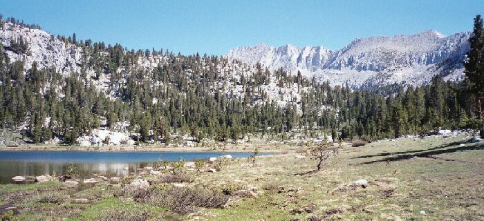
The trail suddenly burst into the open for the stunning panorama seen above. Mt. Hopkins looked majestic with its small mantles of scattered snow fields, and lake 10,393 feet looked like a picture postcard. Once again I faced another wet ford. Dave managed to somehow cross without getting too wet, and I chose to wade.
Lake 10,393 feet, looking up-basin. You can see the spur trail on the right which I think heads for the saddle at the end of the lake to become what is now the main trail to the largest lake in Pioneer Basin. I have seen the other end of that trail, so I know it is there somewhere. I imagine there are camps at the end of the lake.
After getting my shoes back on, I joined Dave at the nearby camp under a tree. We briefly considered camping there and we discussed it, but the mosquitoes decided the matter with their voracious attacks. It was really the only spot we had a problem with the flying bloodsuckers. It was pretty early to be stopping anyway, so there was no reason not to push on. This was a great spot to take pictures, and for a better one, follow the spur trail up the lake a ways and take a picture over the lake.