A Short Trip in the Pioneer Basin Area
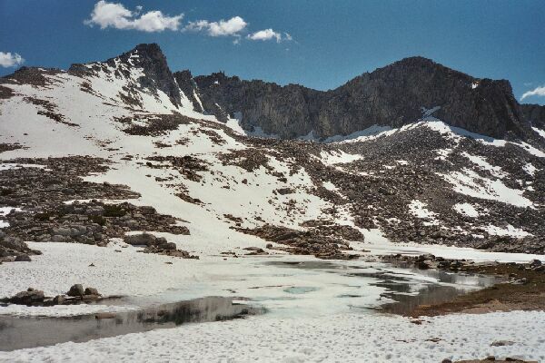
The highest basin lake was just about frozen over with a few spots of open water. Note the moraines everywhere. New grass growing says spring is well under way. Mt. Crocker is to the right of center. Dave takes in the scene.
Highest Pioneer Basin Lake
A Pioneer Basin Trip from Edison Lake, June 2003
We followed grassy swards up into the basin, looking occasionally to the right to the easy (on this side) pass into the McGee area. Getting to the lake proper required maneuvering around a large snow field with its companion ponds. We were just keeping our feet dry and avoiding any unpleasant postholes. It was all still easy.
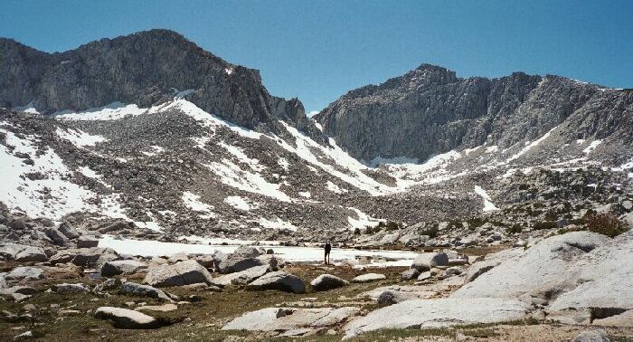
The highest part of the basin is in that circue above the outlet of the lake (which is on the right).
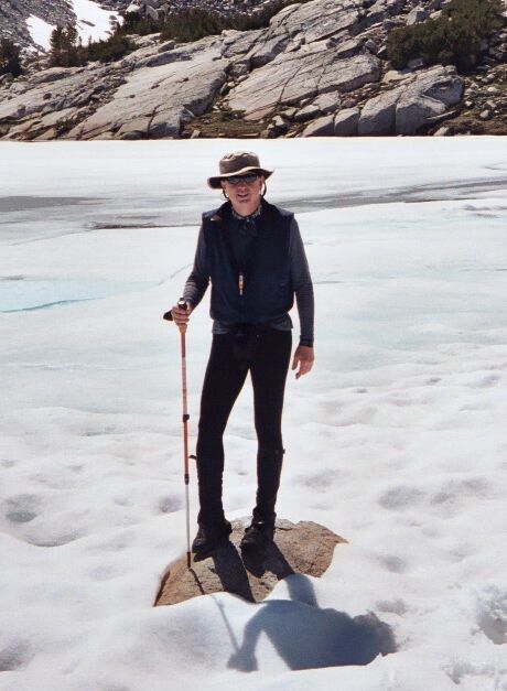
At the lake, we rested, watered, snacked and explored the pools around the outlets, which were kind of interesting due to small fish and clearness of the water. After careful poking, prodding and testing of the ice, we took turns walking out to an isolated rock amid the lake ice and snapped pictures of each other. The surrounding moraines made for an interesting study, and I could clearly see there was an easy way to the upper circue, but we really would not have seen much more than we could already see from the lake outlet. Deeper into basin, it looked like a rock garden and there were no higher lakes to go to. What we should have done was to go up to the pass into the MaGee area and seen the sights. Ah, hindsight.
It's me, the Editor of Sierra Trails. I am actually out in the lake having walked over ice and snow to get out to this island rock. Picture by Dave E.
After a good stay at the lake, we turned our toes to the east side of Pioneer Basin. Again the walking tended to be a trivial class one stroll, better than a lot of Sierra trail.