A Short Trip in the Pioneer Basin Area
Fourth Recess Lake and its outstanding waterfall, the last Sierra backcountry destination of legendary Mountaineer Norman Clyde.
The Fourth Recess
A Pioneer Basin Trip from Edison Lake, June 2003
~2500 feet of gain over ~ 10.5 miles.
Day 3:Another glorious morning in the High Sierra! As soon as there was light, we were up and at the morning chores. It was not long before we were packed and on the trail. As expected, the first elevation loss was a bit eroded and slippery in places, but you could not beat the view with a stick. Soon we were on regular wilderness trail plunging downward. The crossing of the lowest lake outlet was a wet one for me, and Dave managed (at some small risk) to cross dry again. I got my shoes back on and took off down the trail.
It was a small matter getting to the bottom of canyon: of small interest was there were no longer any people in the meadow area along the trail, and I walked up the meadow a ways to check things out. When we reached the junction we took a left to find the crossing of Mono Creek to take the trail into the Fourth Recess. We thought we found a likely spot and once again got our wet shoes on and waded across. We found a pretty knoll to change shoes and observe the park-like area surrounding us.
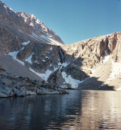
Back on the trail, it first shot downward a little ways then began a gentle climb up the Recess in the most pleasant of surroundings. It did not take long to reach Fourth Recess Lake, and what a fantastic sight it was! Deep shadows were cast into the waters with the sun just then skimming across the tops of the trees. The strong sunlight was reflected off the white granite and snow of the west walls, causing the east walls to glow in the reflection. Then there was that waterfall, now in full flood, roaring and singing in the morning calm. The total drop of the fall was over 700 feet, half of it in a talus slope. The top half was quite active, a combination cascade and fall.
End of the trail, but what a view of the Fourth Recess waterfall!.
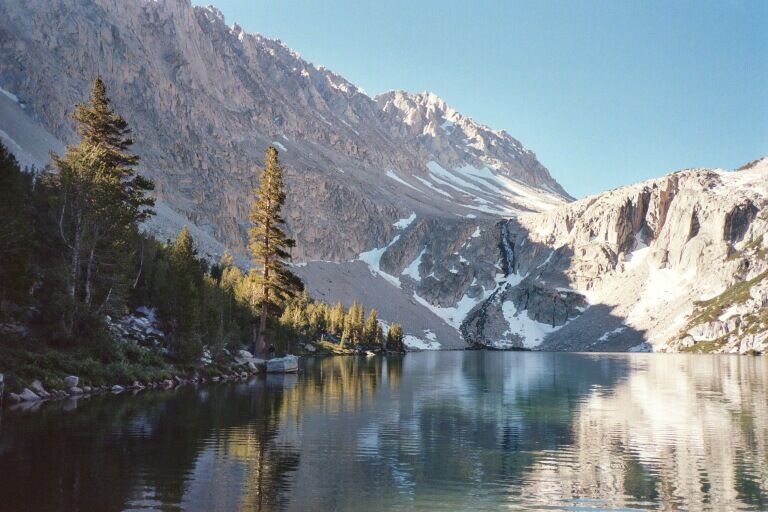
We headed around the lake to the left along a pretty forested moraine on a well established trail. To the left in the trees were camps, which were occupied. As a matter of fact, we had met a few people, all freshly arrived from over Mono Pass. After a bit of walking we broke out of the trees into an open area. Soon after that the trail petered out and gave up to medium to large sized talus. We had a great view of the falls and the surrounding area and I collected a few pictures. There is a way up onto the plateau above the falls and I could only guess how one got up there. While it looked maybe possible from east side, the talus complicated things, and then there was an iffy gully. It looked far more possible on the west shore. I have seen pictures from up there, and it looked interesting if barren.
After we had worn out the view, it was time to head back to the main trail.