A Short Trip in the Pioneer Basin Area
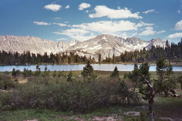
Morning at Lower Hopkins Lake from the outlet, looking north. A well defined trail goes around the lake on the right and into the sunlit trees, where it climbs into the pass to the right just below the peak seen almost dead center.
Lower Hopkins Lake
A Pioneer Basin Trip from Edison Lake, June 2003
From the Fourth recess, it was child's play getting back to Mono Creek. We ran into a bunch of people and we all found a way to cross Mono Creek without getting our feet wet. Soon we were back at the Pioneer Basin junction for a short snack break. When we headed south down the main trail, we were again blissfully alone. The next section was again made up of a number of stream crossings, but we managed (so early in the morning) to make them dry crossings. The warming day would again swell the streams.
Soon enough we found the trail junction to Hopkins Creek Canyon, our next goal of the day. This next section was without a doubt the steepest hiking of the trip. The trail switchbacked steeply up the canyon wall in thick forest cover. After that bit of work, the trail leveled out for what seemed like a long time before breaking out into the open at the stream crossing. Once again it was time for wading shoes to make the easy ford of Hopkins Creek.
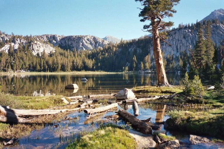
After we got our shoes on, we met the junction after a very short walk. The trail up canyon looked like a good one, but we were headed to Lower Hopkins Lake. After the junction the trail began an increasingly steep climb on narrow wilderness trail. In a particularly grueling section we were treated to a good view of Mono Creek Canyon. After a bit the trail swung left and only climbed moderately, but still it seemed to take its time getting anywhere. The surrounding began to look park-like with open areas decorated with meadow. The outlet stream was way over there somewhere (not on the map) and remained hidden till finally it appeared as we neared the lake. We entered a large flat area with many a spot for tents and came to a large flat rock and soil area to our left where there was obvious camps. We parked our gear and looked around to make sure we were not missing any better camps. We tend to like flat sheltered areas with plenty of clean rock to spread out our gear on. I, for example, like cooking on granite counter-tops. There were other camps, obvious packer camps, but none to our liking. We went back to our gear and set up camp.
Lower Hopkins Lake from near the inlet (of sorts and un-mapped) on the main trail. Mt. Mills peaks its snowy head above the horizon near center picture. The trees directly below Mt. Mills was the location of our camp.
We were not done yet, so after lunch, rehydration and relaxation, we were ready to explore! We got our gear together and headed up the trail.
The surprise was that when we reached the end of the lake (and the fine views of the Mono Divide), the well defined major trail continued up the slope to the north! We followed it upward where it climbed to a flat area at about 10,501 feet, took a right and headed for the obvious saddle to the east. At the saddle the trail headed downhill into Hopkins Creek Canyon, obviously to join the main canyon trail (click on the map button below to see what I mean). Instead of heading down, we took a left across a broad level area to an obvious duck and began an easy traverse to the north-west.