A Solo Hike Along the Silver Divide

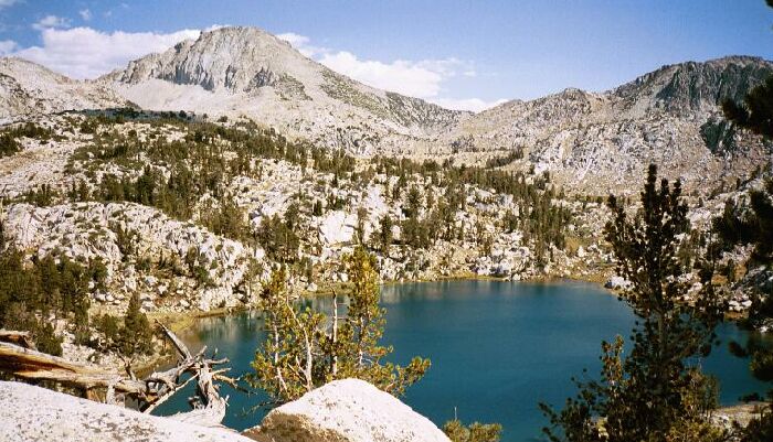
Lake of the Lone Indian. OK, don't get me started. Looking towards Silver Pass from "The Hump".
Over "The Hump"
Silver Divide Trip from Edison Lake Trailhead, August 2001
As the trail swept right and as it climbed what I called "The Hump" (a ridge of point 10,820), it became a less arduous rolling traverse that offered fair views of the lake below and the terrain beyond. I was stopping now and then to breathe and rest because I was starting to get tired, and a picture or two was a good excuse to stop and rest. Eventually the trail crested, much to my relief because I knew there were no more heavy climbs that day. However, the walking was not over, and the next section was a hot and exposed large level area full of soft sand. Still, at that point, slogging through soft sand was preferable to steep switchbacks.
Grassy Lake comes into view.
After the ridge summit and level sandbox, the trail dropped down the other side of the ridge on more conventional hard-pack trail. Actually, had I been less tired, the walk would have been pleasant, featuring views of rocky walls, open forest and green meadows with the occasional singing of falls and cascades. But I was tired and anxious to get into camp and onto my chair. The trail featured many sections of stairs and switchbacks, all of which I would have to ascend on my way out of this area. At one point I could look down canyon and see Grassy Lake, which gave me an idea of how far I had to go. I met one pair of hikers who passed without comment; the first humans I encountered up close on this trip so far. I passed several inviting camps that were too close to the trail for my taste, however one camp was situated near a nice falls and cascade, and looked like an excellent camp. Not long after that I crossed a small stream and unexpectedly came on the brand new trail signs for Wilber May Lake.