A Solo Hike Along the Silver Divide
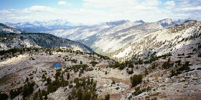
Chief Lake is below, and beyon is Papoose Lake. Above all is the Silver Divide
Silver Pass
Silver Divide Trip from Edison Lake Trailhead, August-September 2001
Silver Pass always seemed odd to me for the reasons I spoke of, and because is not like many other passes in the Sierra. When you are doing the JMT from the north, it is really the second major pass you come to, and it is the first of a series of ever higher passes you will have to top before you finish the JMT. For the rest of your JMT trip, your days will be divided by the topping of yet another pass, day after day.
Silver Pass tops out at about 10,895 feet. Donohue Pass north on the JMT/PCT is actually higher than Silver Pass, at about 11,066. On the 7.5 map, the location of the words "Silver Pass" is actually about an inch too far south, so the map makers were fooled as to where the pass is located. Even from a lofty height some distance from the pass, one is not quite sure where the pass is exactly. Add all this to the fact that Silver Pass is one of the easier passes in the Sierra, a fact one may not appreciate coming from the north.
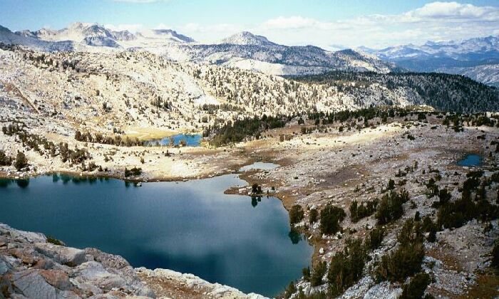
Cascade Vally is below, and the Sierra Crest is on the right. Check out the trail down there.
But one thing for sure, the view from the pass is outstanding and far-reaching. In the distance you can see the Minarets plus Ritter and Banner peaks. Below the Cascade Valley is obvious, providing the deep flank of the Sierra Crest. The Silver Divide and Silver Peak is equally obvious to the left. Below is an array of lakes I recently visited. The first time I came up the pass trail on the JMT trip, I visited the austere shores of memorable Warrior Lake (and Squaw Lake), a worthwhile diversion.