A Solo Hike Along the Silver Divide
That is my pack down there, next to the disintegrating summit sign of Silver Pass.
Down the Other Side of Silver Pass
Silver Divide Trip from Edison Lake Trailhead, August-September 2001
I had a picture taken of myself on my first visit to the pass sign of Silver Pass, and another one taken this time as well (now that there more people and I was on a Sierra highway). That sign has taken a real beating. There is not much left. Time for a metal sign.
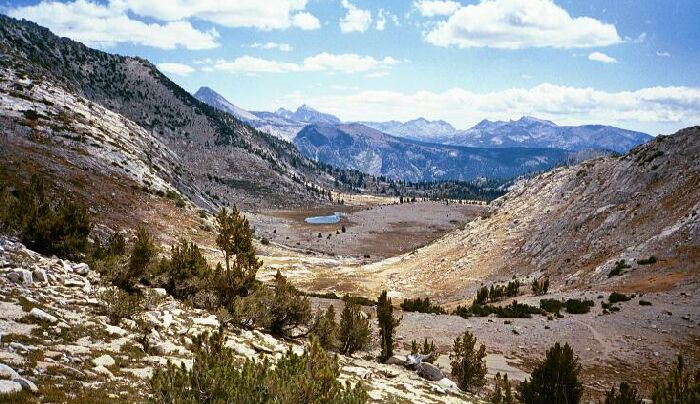
The south-east side of Silver Pass. There is an average looking lake down there around the corner called Silver Pass Lake , but you will see no picture of it from me. Recess Peak can be seen out there on the left, with Volcanoc Knob almost dead center (another picture from below later). Above that can be seen Seven Gables peak. Note the JMT/PCT down there below.
After a short rest and picture taking session, I was back on the trail heading down hill towards Silver Pass Lake, a most average looking lake. At this point the trail was most moderate and soon almost level, unusual for a Sierra pass. Still, it was good high country, so the walking was very fine. Before long the barren moonscape of the high alpine lands gave way to the stunted forests of treeline.