A Solo Hike Along the Silver Divide
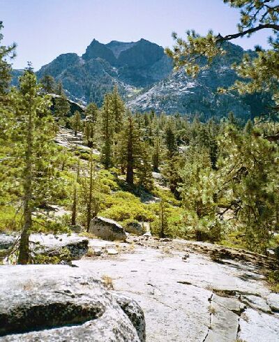
Mono Creek canyon and a bit of the JMT/PCT. There are several similar overlooks along this trail section.
The End of the Trail
Silver Divide Trip from Edison Lake Trailhead, August-September 2001
The trail wound its way downward, down through switchbacks, past the junction that heads towards Pioneer Basin, and down the steps, overlooks and stairs to the crossing of Mono Creek. So late in the season, the creek was a snap to cross. In early season it is an unavoidable wet crossing that is not particularly dangerous, but it is fairly deep, well past the knees. I have crossed it four times, so I know.
After the crossing, the trail fairly levels out with gentle walking on the well-used trail. At this point I was above the main Mono Creek and its large riverbed, walking among some sometimes-massive trees. Before long, the JMT/PCT take a left at a junction to go over a large well-made bridge over the Mono Creek, a wide swift torrent most of the year.
I swear that is a volcano cauldron that was eroded away by glacier action. Recently, I was able to have a closer look at this feature. That cauldron is a short distance from Volcanic Knob.
I went over the bridge to visit the campsite I stayed in when I did the first half of the JMT more than 10 years ago with two others. You have to look carefully for the large campground on your left just across the river, because there is no obvious trail to it. I found it looking not much different than the day I camped in it so long ago. Then it had been raining, and during dinner it was crashing thunder and lightening. I had awakened the next morning in a pool of water. Fortunately, my tent was waterproof and the interior was dry (never tent in a depression). After that the weather improved day by day.
The next section of the JMT is the bane of travelers going south. The dreaded Bear Ridge awaits, with its over 2000 feet of hot climbing on dozens of switchbacks. Having been nearly two weeks on the trail at that point in the trip and being very strong, it was not as bad as anticipated, but I do remember being very tired in camp that night. It is not a trivial hike.
I returned to the trail and headed towards Edison Lake, to face something nearly as bad as Bear Ridge: the lake trail back to Vermilion Resort. This is a bad, over-used, arduous, lengthily and taxing hike one has to do when the boat ferry service is not available. From the JMT to the trailhead near Vermilion Resort, it is 6.5 miles, with a 1394 foot gain and a 1463 foot loss all by itself. Yes, that lake trail SUCKS!
Oh, to be fair, it does have some pleasant views along the way, but its Sierra roller-coaster nature really begins to wear thin in a hurry, and much of the trail is just plain hot and tedious. In total, I had to walk from Mott Lake to the trailhead in 11.1 miles, with 1523 feet in gain and a 3734-foot loss.
I was well glad to get to the trailhead and off the baking trail, and I was really looking forward to a hot shower at the resort. After cleaning up, I got a good Vermilion meal in good company then hit the road home. It had been an excellent trip.
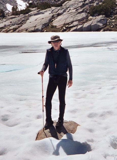
Your author of this feature (Doyle W. Donehoo) in Pioneer Basin, the subject of another story in this area of the Sierra. Picture by Dave E.
The "Next" button will take you back to the cover of this issue of Sierra Trails. The bottom button takes you back to the index page.