A Walk on the Tablelands

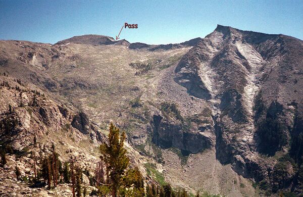
Pterodactyl Pass awaited us above. We would be crossing that easy pass.
The Cross-Country Route
SATURDAY, June 26:
We were up earlier the next morning than the previous morning, and as a matter of fact, every day we got up earlier and earlier until the last day when we were up at 5 AM. The day would prove to be short and interesting rather than grueling like it was for me the day before. The morning was warm and we were glad to be heading higher to cooler
altitudes. We hit the trail not really knowing what to expect: we knew there used to be a trail all the way to Moose Lake, and that it was unmaintained, and we suspected it was once a horse trail. If horses could do it, so could we! From previous older maps I had penciled in
the trail on my map, but it was never really needed. We retraced our steps of the previous day to the eastern meadow and followed the now narrow wilderness trail. There was the usual deadfalls over the trail, and it faded out now and then requiring a search further along the route to find the trail, but for the most part the trail was solidly there. It traverses east in the usual Sierra undulating fashion, further than you would expect looking at the map, until it reaches a small spring fed stream and begins a very steep uphill climb to a ridge top, the crux of the trail. The slog uphill seems to go on forever on the very distinct narrow path until finally topping out at the last at timberline on the ridge at the last tree. Here we rested for the first time that day, dropped our packs and explored the ridge.