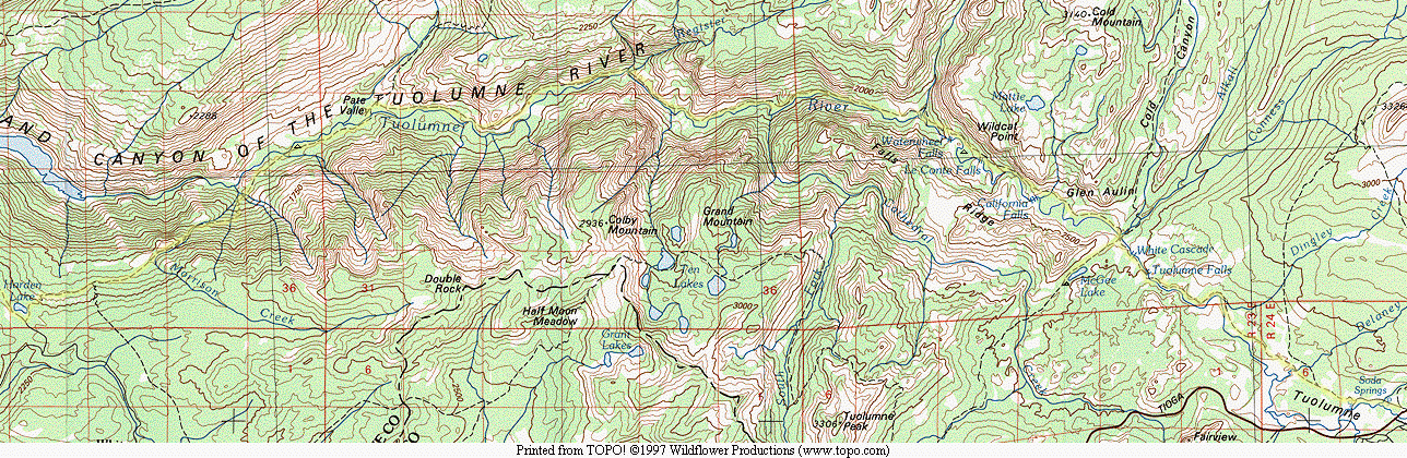
The Grand Canyon of the Tuolumne and Falls
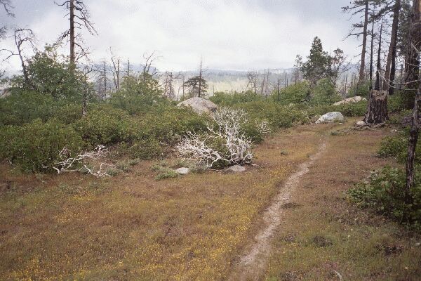
The storm was passing, and the weather would be great for the rest of the trip. This is a typical section of thefirst part of the trip. Evidence of a past fire was everywhere, and the bush had moved in. Spring flowers brighten an otherwise gloomy day.
A Trail Seldom Used
The Grand Canyon of the Tuolumne and Falls, June 2004This trail must be mainly for day-hikers, because there was a zigzag gate that we had to climb over, and it was impossible to get through with a pack. A sneaky thing for a group to do would be to drive down the road and drop off all but one hiker and the packs at the point the trail veers from the road. Then one person could drive back to the RS and park and hike back to the packs sans pack.
In any case, the trail followed the road for quite a distance before finally hooking a right and heading for the back-country.
After about 430 feet of climbing over 3/4 of a mile, we came to a junction (and some day-hikers). Rangers had said backpackers had attempted the left fork (which has a lot of down and up) to Smith Meadow, lost the trail and had to head back out. We could see that the trail got little use, and while it was easy to follow, it did tend to fade away now and then. The area is recovering from a burn, and tends to be open, bushy, viewless and punctuated with burned snags.
We took the right fork and after a bit more of climbing (100+ feet), the trail leveled out on the shoulder of hill 5624 and headed east into thicker forest. I do believe we saw the trail back to RS at a junction, but I do not remember it. We kept heading east into increasing forest cover and at length hit a road.
We were in fine deep forest now, and after following the road for about a level 3/4 mile, we came to the end of the road to a camp called Base Line Camp. There is nothing very special about the camp or area that we could see. We found the trail near the camp and headed out again.
After another 370 feet of climbing and nearly a mile, we came to the first route-finding challenge of the day at Cottonwood Meadow.
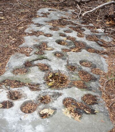
A Native American mortar stone in the middle of the forest near Cottonwood Meadow. This is the most mortar holes I have ever seen in one place, so it and the area must have been heavily used by Native Americans. Perhaps it was in a camp-site.
The trail sort of eased down to the beginning of the meadow and vanished. The meadow was not much to look at: just open sandy stretches with some patches of grass where there was more water. In reality, Cottonwood Meadow is a series of sandy flats occasionally invaded by groups of trees and bushes. Off to the right of the "trail" somewhere was Cottonwood Creek creeping along. When the trail disappeared, we dropped our packs for a snack and a look around to find the trail. Eventually Dave went ahead and picked up a faint track about 100 meters down the mapped trail, so we mounted up and headed out, following the faint here again gone again trail and ducks. Eventually the trail became more defined as it left the "meadow" and regained the forest. It was along this stretch I came on the Native American mortar stone, a probable site of a large camp.
After a while the trail gained another 100 feet or so and topped out on a flat area and descended to a real meadow, lush, swampy and grassy. The trail disappeared for good this time into water and bog and we could see no trace of it in the meadow. It was getting late, and the flat area above the meadow looked good for a camp (amid some big trees near a thick forest), and Cottonwood Creek was nearby for water, so we decided to call it a day and camp.
It did not take long to set up camp and round up dinner. After a bit of exploring (still no trail), we turned in to conclude a very busy day.