The Grand Canyon of the Tuolumne and Falls

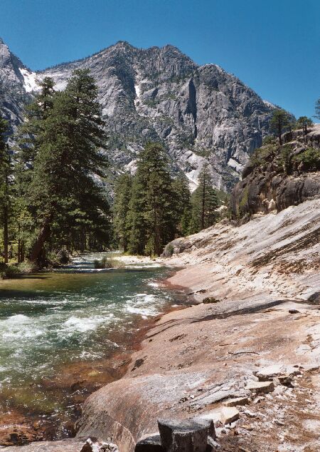
North of Point 6316 is a long valley and this section of trail. This is looking down river. As you can see, the trail is blasted out of solid rock. The only named feature here is the river.
A Long Walk Before Lunch
The Grand Canyon of the Tuolumne and Falls, June 2004Back at our packs, Dave went ahead and was to find a good lunch site with a view. I followed but Dave was soon out of sight: his forte is climbing steep grades. I on the other hand try to just stay within my breathing, keep going and keep a moderate pace. I was still a bit tired from the hike the day before, so my energy level was not at its highest. On top of that, it was beginning to get noticeably hot. To compound things was the steepest hike of the day just in front of me.
After leaving point 5637, the trail heads for an even higher point by the means of numerous tight steep switchbacks. I hit this section and began the grinding slog upwards thinking the only saving grace of this section was that it was in and out of shade. I plodded to the top and was glad that section was done and over. I was hot, hungry and wanted to sit for a spell.
I took a look at the view (still no picture-worthy views of Muir Gorge) and saw no sign of Dave. The top was very open with plenty of white granite (similar to point 5637) which tended to reflect sunlight and warm things up. I though for sure Dave would stop there because of the grand open views, but I saw no sign of him. What I didn't know was that Dave was there, but perhaps he and his pack were out of sight, or I did not look in the right direction. A bit miffed, I went on. Lesson: communicate your plans clearly to each other.
Looking up river near the spot of the picture above this one, and also near my lunch spot. Still a lot of no-name mountains and features in the heart of the wilderness.
The trail fairly leisurely lost the altitude so recently gained with sweat, and right off the bat left the hot open for the cool shade of a small forest. Eventually the trail met the river near where the river bent upstream to the east, granting the hiker a long level section of walking. At one point the trail edged the river where the trail was blasted out of solid rock, similar to sections along the Merced River.
Towards the end of this section near Cathedral Creek, having seen no sign or footprint of Dave, I found a spot in the sun to dry out, sit and have lunch. I had gone about two miles from point 5637. Sure enough, Dave shortly showed up and sat a while. Later Dave went on (he already had lunch), and was to meet me at a particular point ahead.