Mt. Whitney From Cottonwood Lakes
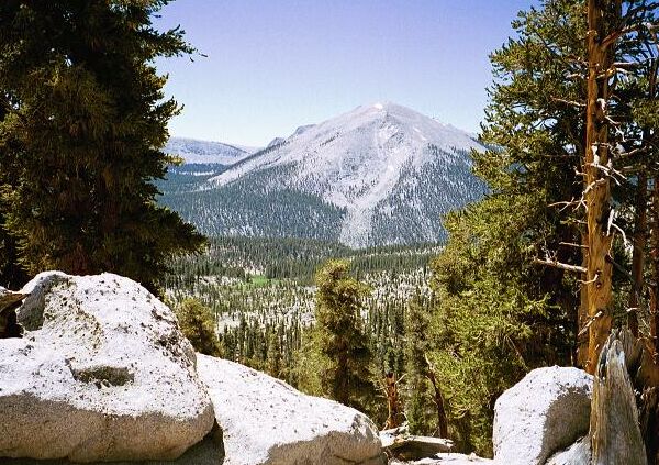
The twin of Mt. Guyot, Mt. Anna Mills (12,064 feet), as seen from Guyot Pass. Below can be seen the meadow of Guyot Creek.
Guyot PassMt. Whitney Trip from Cottonwood Lakes Trailhead. June 2000.
The next trail section was the hardest work of the day, because after the ford the trail began switchbacking upward on the steep Guyot lateral moraine. Fortunately, the trail was well graded and allowed hikers to maintain a good rhythm and steady progress. As the top of the moraine climb neared, the more lush surroundings of the Rock Creek drainage gave way to the more dominate theme of the next few miles: dry. The trees became sparser and the ground became more sandy and sterile. The top of the moraine featured views of Mt. Guyot and another twin of Guyot across the Rock Creek canyon, and little else. As we would see, the trail from Soldier Lakes to Crabtree is fairly uninteresting. But then again, an uninteresting day in the Sierra is better than the best day at work back in "civilization".
The trail leveled out among the widely scattered trees and made its way to the lush corridor of Guyot Creek, the last chance for water until Crabtree. The ford featured a large number of almost level campsites and a nearby meadow, most likely used by horse-packers stock. It also featured an active population of mosquitoes, which we had to contend with as we ate "Lunch Part 1" and filled all of our water bottles. Dave soon took off for Guyot Pass, and after a short time I also fled the pleasant but bug infested surroundings.
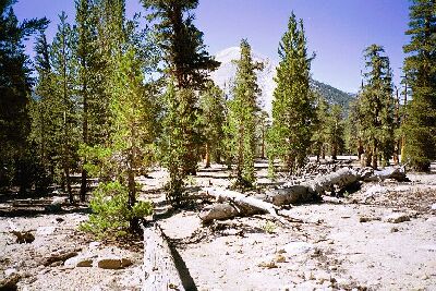
After climbing to the top of the Guyot moraine, you are greeted by this dry sparse forest.
Once again the trail and views gave way to sparsely treed dry landscape as the trail climbed gently towards the pass. Below the pass the trail began switchbacking upwards becoming steeper and steeper as it approached the top. After laboriously hauling myself up the last few excessively steep horse-steps to the top of the pass, it abruptly leveled out to large gruss paved area with plenty of helpful granite rocks and shelves, which happened to be occupied by a large number of people when I got there. The people were a mixed Boy Scout group and they were headed in the same direction we were going. However, they had not been long on the trail that day, having camped back at ford at Rock Creek. It was time for "Lunch Part 2" as we chatted with the group, which departed about 10 minutes after I arrived.