Mt. Whitney From Cottonwood Lakes
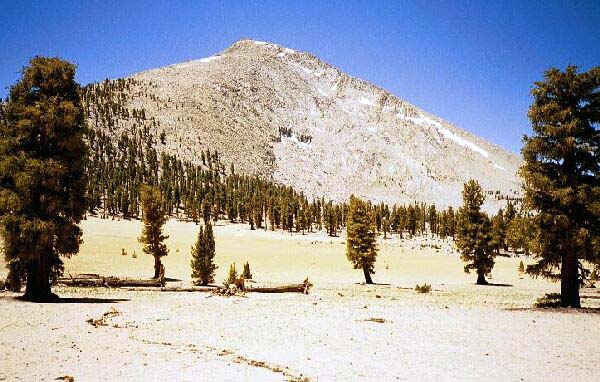
The "Guyot Desert" of Guyot Flat below Mt. Guyot as seen from the trail. Perhaps water pools here on occasion. An interesting feature in a warm area.
The Desert of Guyot FlatMt. Whitney Trip from Cottonwood Lakes Trailhead. June 2000.
After our break for lunch, we also departed after enjoying probably the most interesting point on the journey so far that day. That is not saying a lot considering most of the trail was is viewless forest. This trip was for a destination, a fact which I reminded myself of on the long trudge. The pass offered a fine view of Mt. Gyot, mainly a huge rock heap and fairly uninteresting. Trees mostly obscured the sand flats below, and the rest of the views consisted of rolling tree-covered hills. I had seen Mt. Gyot from several angles in my Sierra travels, and I always told myself I would someday be on its shoulder on the PCT on my way to Mt. Whitney, and finally at last I was there. It was just a landmark on the way to Mt. Whitney.
Looking down towards the small dry desert of Guyot Flat from Guyot Pass.
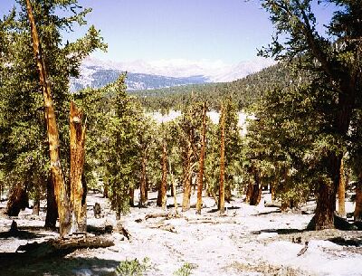
The trail on the north side of Guyot Pass was an improvement over the south side, consisting of gentle switchbacks that deposited the hiker on the outskirts of the small desert known as Goyot Flat. The flat is a large round sand filled depression devoid of any apparent life, and on a hot day you have to be glad the trail did not run down the middle of it. As it was, the open sandy areas reflected light and heat in the still air and if it wasn't for the fact that the trail was fairly level, I would have been overheated. Thick trees studded the sandy terrain, and the trail tended towards being level, trending slightly down hill, making travel about as swift as you might care to go. The view over the flat gave way to impressive glimpses through the trees of the jagged and fluted Great Western Divide over Chagoopa Plateau.