Mt. Whitney From Cottonwood Lakes
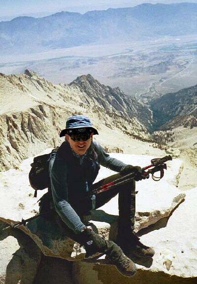
O.K., that's me, with the Lone Pine Creek drainage at my back. Also below can be seen the unusual Alabama Hills and the awesome Owens Valley. (Due to the high contrast of this image, I have had to doctor this picture. Can you tell?) In front of me was a throng of hikers, most talking on their cell-phones. Time to move along.
The Summit of Mt. Whitney!Mt. Whitney Trip from Cottonwood Lakes Trailhead. June 2000.
I marched right up to the large stone with the plaque on it and jumped on top, while scanning other rocks that might be the real summit. I stood on all of the high rocks just to make sure, noting at least two benchmarks. Whichever rock it was, for a brief moment in time, the summit was mine!
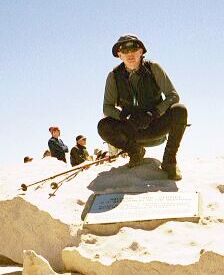
The summit of Mt. Whitney at last, and this is all I have to show for it? Oh well. (That is me, happy I finally made this trip.)
...Which I shared with a small crowd of people: some of them rock-climbers, some of them fresh from the Mountaineers Route, some of them from fresh from camp on the east side or Whitney Portal, some of them cell-phoning.
The plaque on the summit of Mt. Whitney. Left of middle image on the horizon is Table mountain. Get a map, and as Table Mountain as a starting point, identify the other peaks on the Great Western Divide.
As more people arrived, it became a small mob from which Dave and I retreated after a few pictures. It was getting downright crowded! We needed solitude.