The Benson Lake Loop

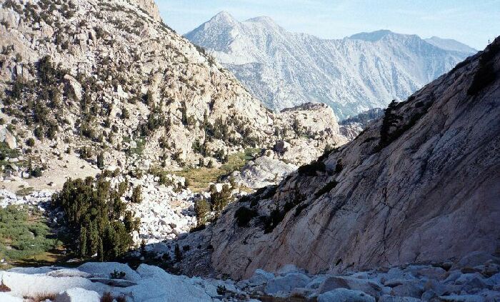
You can see the pocket valley below which is above the Crown Lake valley. The trees below actually have at least one small camp. By now, you know the name of the mountains beyond on the horizon. The Snow lake trail goes off to the left.
Mule Pass
The Benson Lake Loop, August 2002
This was a great and memorable section of trail. It climbed quickly and drew near a sometimes-exposed stream among the rocks and talus, which justified a tiny bivy camp on a small tree sheltered ridge. After a section of meandering, the trail began an earnest sharp altitude eating switch-backing climb. This trail segment reminded me of the upper portions of Colby Pass with its rock and talus nature and its many switch-backs. As it climbed, the views improved by leaps and bounds, although I was not exactly leaping and bounding up that trail. The junction meadow began to look far below me, and I could see the exposed, hot and rocky trail leading up to Snow Lake. Many of the peaks of the area began to show themselves in the early morning sunlight as I began to climb high enough for them to be seen.
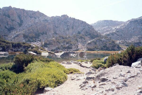
Just as you reach the first leveling off beyond some low trees, this comes suddenly into view: The pass valley just before the pass itself. A small summit lake with possible camping on the left of the tarn. The trail goes to the right of the lake and heads for the obvious small valley cut.
At last the trail reached a shoulder providing the last good views to the northeast and down to the junction meadow, then it was around a corner and into shade below a false summit covered with head high Whitebark Pines. The last grinding switch-backs delivered me into the trees and less severe elevation gain.
Looking back to the lake and where I took the previous picture. Beyond is Crown Point.
Then a surprise, and only if you had not studied every detail of the map. I came out of the bush-like trees to be greeted by a small picturesque lake of reasonable size. It was set in a broad grassy vale with a level meadow maybe three times larger than the lake. All this was held in a kind of bowl lined with rocks and small peaks. One end of the lake had some rocky tree smattered mounds that may have sheltered some camps, providing it was not over-run by "No Camping Here" signs. I didn’t see any, but then I did not go over for a look either.
That is actually the pass just ahead, a low point on the right and to the right of the trail seen here. The flat peak at center picture is a part of the Sierra roof pendant. Part of the Sawtooth Ridge is on the right skyline.
Near the lake waters the trail tiresomely climbed up a little bit to crest a bushy shoulder before heading back to the large meadow. I could see a use trail branching right, which obviously headed for two gullies leading to the crest and an undoubtedly spectacular view of Slide Canyon and "The Slide". On the main and now faint trail through the wet meadow, ahead I could see more climbing to the actual pass not far ahead. I slogged these last steps and reached the pass. I found an elevated section of the pass with a view and set my gear down. Time for a rest, a snack and a bunch of pictures!