Circle the Cirque Crest

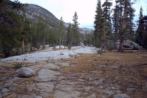
Looking up the Glacier Creek canyon near the creek, you can see this part of the Steve Roper "Sierra High Route". As can be seen, the cross country is eaasy through here, and we have vowed to return and do this part of the route.
Glacier Creek
Circle The Cirque Crest - By D.W.Donehoo (All rights reserved)
The trail levels out near Daughtery Creek and travels through and by meadows, forests, slab granite, and streams. Near the cross-country route to The Lake of the Fallen Moon we found an excellent camp near the trail and a stream, with a nearby open granite shoulder with good views into the creek drainage. The muggy weather gave us a break by blocking the sun long enough for the short 400 foot climb out of the drainage to the drift-fence and gate. From the gate, the trail gets interesting by doing a long traverse of the hillside on good trail until finally making a last plunge to the north fork creek drainage that leads to State Lakes. From there the trail begins a gradually steepening climb climaxing with a very steep uphill climb to the lateral moraine of Glacier Creek. Stopping at the creek for water, it began to sprinkle some. We decided to eat and wait out the drizzle: we had another 400 foot climb ahead, and we had no desire to do it in rain gear. The area was very pleasant, with a trail leading up Glacier Creek canyon. We vowed to return and do the Glacier Lakes part of the Sierra High Route. Eventually the rain died off, and once we were on the trail the sun came out just in time for the steep climb.