Kern-Kaweah and Kaweah Basins

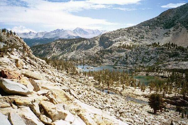
The outlet of the Kaweah Basin. The high-point on the horizon is Mt. Whitney, the target of my previous trip. Below is the lowest large lake of the basin, where there is at least one good camp. Note the white granite of this side of the stream and lake, and the darker gray of the volcanic material of the other side.
"Picket Col" Views
Kern-Kaweah and Kaweah Basins via Colby Pass, September, 2000.
A somewhat steep but easy hike up the obvious col brought us to the summit and our first views of the Kaweah Basin.It was an impressive view but not as stunning as I expected. For one thing, it was definitely rougher than I expected, with red talus in front of us and deep channels scoring the valley below. However, it was indeed a grand view worth seeing, and we were gad we were there. To the left the opening of the valley framed a view of Mt. Whitney on the Sierra Crest, and below that at the head of the valley below us was a shallow complex lake surrounded by a thin forest.
My first view of the Kaweah Basin. Near the center of the picture is Kaweah Pass below Mt. Kaweah, the highest point of the Kaweah Peaks Ridge.
Directly below us was a broken talus field that was to be easily managed by ramps and gullies. To the right was the real attraction of the area, the Great Western Divide dominated by a rock formation known as "Square Top". The only thing to compare this section of the range with would have to be the Minarets, both formations volcanic in origin. At the left end of the range visible to us were Kaweah Peak and the obvious Kaweah Pass, as steep loose talus slog from the stories I have been told and from what I could see. The whole set of peaks look like the lower jaw teeth of some giant carnivore that never brushed or flossed. The peaks were a uniform dark brown in color is looked quite forbidding.