A Backpack to the Remote Lyell Fork of the Merced River
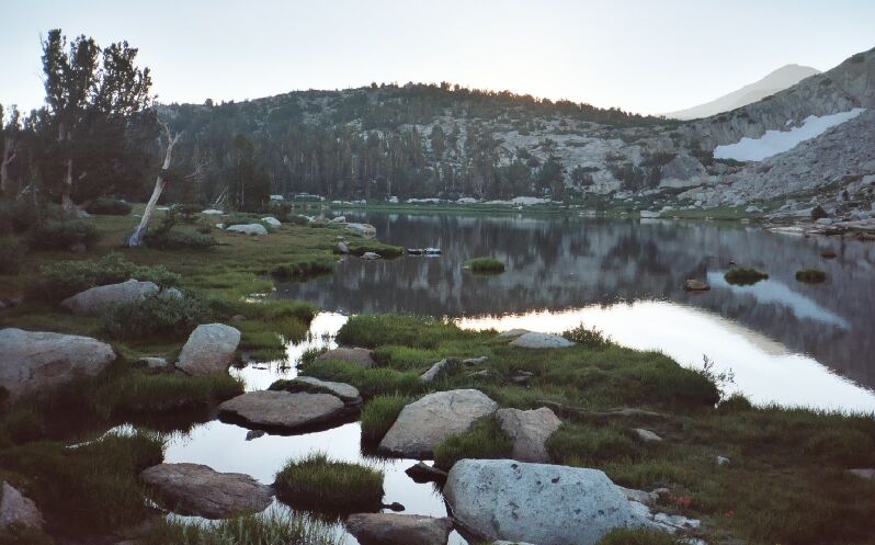
Fletcher Lake in early morning light, looking east. Camping is nearby to the left, but not too near.
Vogelsang HSC
A Trail and Cross-Country Route to the Lyell Fork, July 2007
We headed towards the Vogelsang High Sierra Camp (HSC) where I at least planned to take a break. This section can really be a capper because it starts as a shallow climb that steadily gets steeper, and finishes at a very steep fish-hook switch-back that sucks the life right out of you. When I reached that last section, the fatigue really hit me and I was more than ready for a rest. When I reached the signed junction with its nice trees and rocks, I threw down my pack and reached for the Deet. We were being attacked.
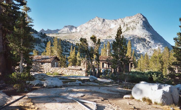
The Vogelsang HSC in its disassembled state off-season. In this particular year (2005), it may never have opened. In the distance, Vogelsang Peak and the canyon of Vogelsang Lake.
The worst of the mosquitoes seemed to be around the Vogelsang HSC (camping available) and at the 9000 to 10,000 foot altitude, mainly owing to the many ponds, lakes and streams in the area. The worst of the mosquito season usually lasts about a month, and that month is usually July. Not this year. Spring came early after a dry winter. Mosquitoes show up in the late snowmelt (following the snowmelt upward) and at the peak of the wildflower season when the ‘skeeters help in pollination. When they are not doing that, they are attacking in swarms at their peak. No sooner than I had doffed my pack than they were on me like flies on…well...you know. After a fit of deet spraying they left me alone long enough to have a rest in my chair and eat more lunch. Dave seemed antsy and would have preferred to push on I think (he hates mosquitoes with a dark and furious passion that is almost disturbing to behold), but amused himself checking out the structures of the now nearby High Sierra Camp and comparing it with his ancient Boy Scout memories when he was there last.
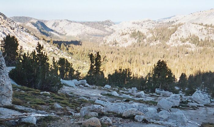
Looking down the Fletcher Creek drainage with Emeric Lake in the distance.


